Area Overview for CO12 4EG
Photos of CO12 4EG
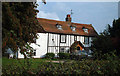
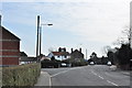
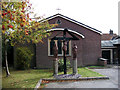
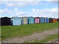
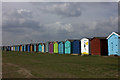
52 photos from this area
Area Information
Key information about the CO12 4EG including its size, population, and administrative classification.
- Area Type
- Postcode
- Area Size
- 9116 m²
- Population
- 1801
- Population Density
- 2064 people/km²
House Prices in CO12 4EG
10
Properties
£230,107
Average Sold Price
£67,000
Lowest Price
£340,000
Highest Price
Showing 10 properties
| Address | Type | Beds | Baths | Last Sale Price | Last Sale Date | |
|---|---|---|---|---|---|---|
| 103 Fronks Road, Dovercourt, CO12 4EG | Detached | 4 | 2 | £300,000 | May 2016 | |
| 128 Fronks Road, Dovercourt, CO12 4EG | Bungalow | 3 | 1 | £340,000 | Jun 2011 | |
| 101 Fronks Road, Dovercourt, CO12 4EG | house | - | - | £275,000 | Feb 2010 | |
| 105 Fronks Road, Dovercourt, CO12 4EG | Detached | 5 | 2 | £268,750 | Jun 2008 | |
| 134 Fronks Road, Dovercourt, CO12 4EG | Bungalow | 3 | - | £275,000 | Dec 2006 | |
| 107 Fronks Road, Dovercourt, CO12 4EG | Detached | - | - | £85,000 | Sep 1998 | |
| 136 Fronks Road, Dovercourt, CO12 4EG | Detached | - | - | £67,000 | Mar 1997 | |
| 130 Fronks Road, Dovercourt, CO12 4EG | Bungalow | - | - | - | - | |
| 132 Fronks Road, Dovercourt, CO12 4EG | Detached | - | - | - | - | |
| Birchwood, 99A Fronks Road, Dovercourt, CO12 4EG | Detached | - | - | - | - |
Energy Efficiency in CO12 4EG
Amenities
Schools
| Rank | School | Type | Entry gender | Ages |
|---|
Explore more schools in this area
Go to Schools tabDemographics
Household Size
Two person
most common
Accommodation Type
Houses
most common
Tenure
86
majority
Ethnic Group
White
most common
Religion
N/A
most common
Household Composition
N/A
most common
Age
47
median
Adults (30-64 years)
most common
Household Deprivation
N/A
with no deprivation
NS-SEC
34
in Lower managerial occupations
Explore more demographic insights in this area
Go to Demographics tabPlanning
Planning Constraints
- Flood RiskPremium
- Ramsar Wetland SitesPremium
- Area of Outstanding Natural BeautyPremium
- Protected Nature ReservePremium
- Protected WoodlandPremium