Area Overview for CO12 4DN
Photos of CO12 4DN
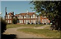


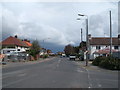
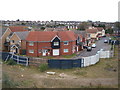
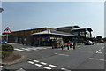
32 photos from this area
Area Information
Key information about the CO12 4DN including its size, population, and administrative classification.
- Area Type
- Postcode
- Area Size
- 1.2 hectares
- Population
- 1644
- Population Density
- 4237 people/km²
House Prices in CO12 4DN
13
Properties
£227,500
Average Sold Price
£160,000
Lowest Price
£390,000
Highest Price
Showing 13 properties
| Address | Type | Beds | Baths | Last Sale Price | Last Sale Date | |
|---|---|---|---|---|---|---|
| 408 Main Road, Harwich, CO12 4DN | Detached | 4 | 2 | £390,000 | Jun 2021 | |
| 406 Main Road, Harwich, CO12 4DN | Bungalow | 3 | 1 | £265,000 | Mar 2020 | |
| 365 Main Road, Harwich, CO12 4DN | Detached | 4 | 1 | £297,500 | Dec 2017 | |
| 404 Main Road, Harwich, CO12 4DN | Bungalow | 2 | 1 | £210,000 | Mar 2017 | |
| 359 Main Road, Harwich, CO12 4DN | Terraced | 3 | 1 | £160,000 | Mar 2016 | |
| 351 Main Road, Harwich, CO12 4DN | Terraced | 3 | 1 | £161,000 | Jan 2016 | |
| 355 Main Road, Harwich, CO12 4DN | Terraced | 3 | - | £174,000 | May 2015 | |
| 349 Main Road, Harwich, CO12 4DN | house | - | - | £165,000 | Mar 2012 | |
| 398 Main Road, Harwich, CO12 4DN | house | - | - | £225,000 | Sep 2007 | |
| 363A Main Road, Harwich, CO12 4DN | Land | 1 | - | - | - |
Page 1 of 2
Energy Efficiency in CO12 4DN
Amenities
Schools
| Rank | School | Type | Entry gender | Ages |
|---|
Explore more schools in this area
Go to Schools tabDemographics
Household Size
Two person
most common
Accommodation Type
Houses
most common
Tenure
75
majority
Ethnic Group
White
most common
Religion
N/A
most common
Household Composition
N/A
most common
Age
47
median
Adults (30-64 years)
most common
Household Deprivation
N/A
with no deprivation
NS-SEC
24
in Lower managerial occupations
Explore more demographic insights in this area
Go to Demographics tabPlanning
Planning Constraints
- Flood RiskPremium
- Ramsar Wetland SitesPremium
- Area of Outstanding Natural BeautyPremium
- Protected Nature ReservePremium
- Protected WoodlandPremium