Area Overview for CO12 3FF
Photos of CO12 3FF
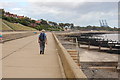
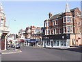
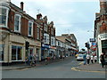
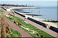
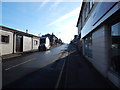
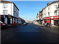
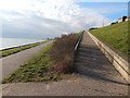
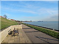
100 photos from this area
Area Information
Key information about the CO12 3FF including its size, population, and administrative classification.
- Area Type
- Postcode
- Area Size
- 3.2 hectares
- Population
- 1702
- Population Density
- 4567 people/km²
House Prices in CO12 3FF
50
Properties
£204,176
Average Sold Price
£96,000
Lowest Price
£287,500
Highest Price
Showing 50 properties
| Address | Type | Beds | Baths | Last Sale Price | Last Sale Date | |
|---|---|---|---|---|---|---|
| 126 Heron Way, Harwich, CO12 3FF | Terraced | 4 | 1 | £287,500 | Mar 2025 | |
| 122 Heron Way, Harwich, CO12 3FF | Terraced | 3 | 1 | £240,000 | Sep 2024 | |
| 74 Heron Way, Harwich, CO12 3FF | house | - | - | £227,000 | Feb 2022 | |
| 72 Heron Way, Harwich, CO12 3FF | house | 4 | - | £265,000 | Sep 2021 | |
| 64 Heron Way, Harwich, CO12 3FF | Semi-detached | 4 | 2 | £240,000 | Apr 2021 | |
| 62 Heron Way, Harwich, CO12 3FF | Terraced | 3 | 1 | £212,500 | Sep 2020 | |
| 130 Heron Way, Harwich, CO12 3FF | house | 4 | 1 | £220,000 | Sep 2019 | |
| 154 Heron Way, Harwich, CO12 3FF | Semi-detached | 4 | 1 | £215,000 | Jan 2018 | |
| 60 Heron Way, Harwich, CO12 3FF | Terraced | 4 | - | £212,500 | Dec 2016 | |
| 120 Heron Way, Harwich, CO12 3FF | Terraced | 3 | 1 | £133,000 | Feb 2014 |
Page 1 of 5
Energy Efficiency in CO12 3FF
Amenities
Schools
| Rank | School | Type | Entry gender | Ages |
|---|
Explore more schools in this area
Go to Schools tabDemographics
Household Size
Two person
most common
Accommodation Type
Houses
most common
Tenure
64
majority
Ethnic Group
White
most common
Religion
N/A
most common
Household Composition
N/A
most common
Age
47
median
Adults (30-64 years)
most common
Household Deprivation
N/A
with no deprivation
NS-SEC
26
in Lower managerial occupations
Explore more demographic insights in this area
Go to Demographics tabPlanning
Planning Constraints
- Flood RiskPremium
- Ramsar Wetland SitesPremium
- Area of Outstanding Natural BeautyPremium
- Protected Nature ReservePremium
- Protected WoodlandPremium