Area Overview for CO11 2DL
Photos of CO11 2DL
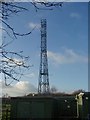
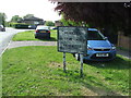
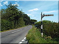
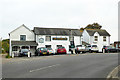
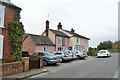
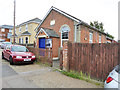
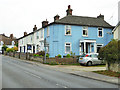
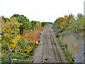
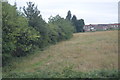
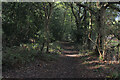
36 photos from this area
Area Information
Key information about the CO11 2DL including its size, population, and administrative classification.
- Area Type
- Postcode
- Area Size
- 2.0 hectares
- Population
- 1489
- Population Density
- 1528 people/km²
House Prices in CO11 2DL
34
Properties
£199,930
Average Sold Price
£47,000
Lowest Price
£375,000
Highest Price
Showing 34 properties
| Address | Type | Beds | Baths | Last Sale Price | Last Sale Date | |
|---|---|---|---|---|---|---|
| 26 Middlefield Road, Mistley, CO11 2DL | Semi-detached | 5 | 2 | £375,000 | Dec 2025 | |
| 20 Middlefield Road, Mistley, CO11 2DL | house | 3 | - | £230,000 | May 2020 | |
| 30 Middlefield Road, Mistley, CO11 2DL | Semi-detached | 3 | 1 | £259,300 | Apr 2020 | |
| 12 Middlefield Road, Mistley, CO11 2DL | Semi-detached | 3 | 2 | £280,000 | Oct 2019 | |
| 32 Middlefield Road, Mistley, CO11 2DL | Semi-detached | 3 | 1 | £240,000 | Sep 2018 | |
| 29 Middlefield Road, Mistley, CO11 2DL | Semi-detached | 3 | - | £163,000 | Aug 2014 | |
| 2 Middlefield Road, Mistley, CO11 2DL | Semi-detached | 3 | 2 | £192,000 | Aug 2013 | |
| 28 Middlefield Road, Mistley, CO11 2DL | Semi-detached | - | - | £165,000 | Dec 2008 | |
| 3 Middlefield Road, Mistley, CO11 2DL | Terraced | - | - | £48,000 | Feb 2000 | |
| 1 Middlefield Road, Mistley, CO11 2DL | Terraced | - | - | £47,000 | Feb 1996 |
Page 1 of 4
Energy Efficiency in CO11 2DL
Amenities
Schools
| Rank | School | Type | Entry gender | Ages |
|---|
Explore more schools in this area
Go to Schools tabDemographics
Household Size
Two person
most common
Accommodation Type
Houses
most common
Tenure
66
majority
Ethnic Group
White
most common
Religion
N/A
most common
Household Composition
N/A
most common
Age
47
median
Adults (30-64 years)
most common
Household Deprivation
N/A
with no deprivation
NS-SEC
31
in Lower managerial occupations
Explore more demographic insights in this area
Go to Demographics tabPlanning
Planning Constraints
- Flood RiskPremium
- Ramsar Wetland SitesPremium
- Area of Outstanding Natural BeautyPremium
- Protected Nature ReservePremium
- Protected WoodlandPremium