Area Overview for CO11 1PQ
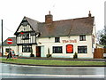
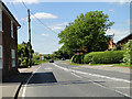
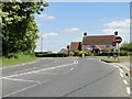
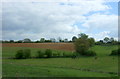
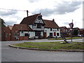
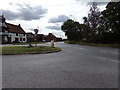
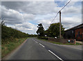
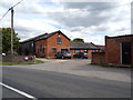
Photos of CO11 1PQ


Area Information
CO11 1PQ is a small residential cluster in Suffolk, England, situated near the River Stour and close to the Essex border. With a population of 1,456 and a density of 213 people per square kilometre, it is a compact, tightly knit community. The area’s history is steeped in Saxon roots and Viking influences, evidenced by the Brantham Hoard of 90 silver coins discovered in 2003 and the Domesday Book references. Modern Brantham retains its village charm, with St Michael and All Angels Church, rebuilt in 1869, standing as a historical anchor. The area is part of “Constable Country,” linked to artist John Constable’s sketches of the surrounding landscape. Residents enjoy proximity to Manningtree, 2 miles to the south, and Ipswich, 9 miles to the northeast, offering a balance of rural tranquillity and accessible town amenities. The village’s compact size and low population density suggest a community focused on local connections, with a strong sense of place shaped by its historical and natural surroundings.
- Area Type
- Postcode
- Area Size
- Not available
- Population
- 1456
- Population Density
- 213 people/km²
The property market in CO11 1PQ is characterised by high home ownership (88%) and a focus on houses, which dominates the accommodation type. This suggests a market skewed towards owner-occupied properties rather than rentals, reflecting a community that values long-term investment in residential assets. The small population and low density imply a limited number of properties, likely concentrated in individual homes rather than apartments or terraced housing. Buyers in this area may find a niche market, where properties are fewer but potentially more spacious, catering to those seeking rural living with a strong sense of community. The lack of rental properties may indicate a stable, low-turnover market, where homes are held by residents for extended periods. For prospective buyers, this environment offers a chance to acquire property in a historically rich, low-density setting, though competition may be limited due to the area’s small size.
House Prices in CO11 1PQ
No properties found in this postcode.
Energy Efficiency in CO11 1PQ
Residents of CO11 1PQ have access to a range of nearby amenities, including retail and rail services. The area’s retail options include the East of England Co-operative Co and Tesco Manningtree, providing essential shopping and grocery needs within a short distance. The presence of multiple railway stations, such as Mistley and Manningtree, enhances connectivity, allowing residents to travel easily to nearby towns for work, leisure, or social activities. The village’s historical and natural features, like the River Stour and St Michael and All Angels Church, contribute to a distinct character that blends rural tranquillity with accessible amenities. While the immediate area may lack large-scale leisure facilities, the proximity to Manningtree and Ipswich offers additional options for dining, entertainment, and cultural activities. This balance of local convenience and regional accessibility ensures a lifestyle that is both practical and enriched by the area’s heritage.
Amenities
Schools
The nearest school to CO11 1PQ is Brooklands Primary School, a primary school with an Ofsted rating of “good.” This institution serves the local community, providing education for younger children in the area. The presence of a primary school with a positive rating is a significant factor for families considering the area, as it ensures access to quality early education without the need for long commutes. The absence of secondary schools or additional educational institutions in the immediate vicinity means that families may need to travel to nearby towns like Manningtree or Ipswich for secondary education. However, the proximity of Brooklands Primary School supports a family-friendly environment, where children can attend school locally, reinforcing the area’s appeal to those prioritising convenience and community cohesion.
| Rank | School | Type | Entry gender | Ages |
|---|
Explore more schools in this area
Go to Schools tabDemographics
The community in CO11 1PQ is predominantly composed of adults aged 30–64, with a median age of 47. This suggests a mature, stable population, likely with long-term ties to the area. Home ownership is exceptionally high at 88%, indicating a strong preference for private residences over rental properties. The accommodation type is primarily houses, reflecting a low-density, residential character. The predominant ethnic group is White, with no data provided on other demographics. The low population density of 213 people per square kilometre further underscores the area’s rural nature, where households are likely spread across individual properties rather than high-density housing. This profile aligns with a community prioritising family-oriented living, with residents potentially drawn to the area’s historical charm and proximity to natural landscapes. The absence of specific data on deprivation or diversity means the quality of life is inferred from the stability of home ownership and the demographic consistency.
Household Size
Accommodation Type
Tenure
Ethnic Group
Religion
Household Composition
Age
Household Deprivation
NS-SEC
Explore more demographic insights in this area
Go to Demographics tabPlanning
Planning Constraints
- Flood RiskPremium
- Ramsar Wetland SitesPremium
- Area of Outstanding Natural BeautyPremium
- Protected Nature ReservePremium
- Protected WoodlandPremium