Area Overview for CO11 1FG
Photos of CO11 1FG
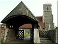
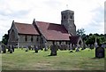
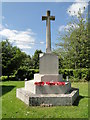
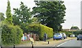

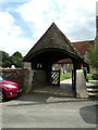
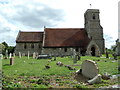
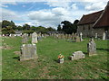
47 photos from this area
Area Information
Key information about the CO11 1FG including its size, population, and administrative classification.
- Area Type
- Postcode
- Area Size
- 28.8 hectares
- Population
- 1456
- Population Density
- 213 people/km²
House Prices in CO11 1FG
6
Properties
£569,100
Average Sold Price
£407,000
Lowest Price
£730,000
Highest Price
Showing 6 properties
| Address | Type | Beds | Baths | Last Sale Price | Last Sale Date | |
|---|---|---|---|---|---|---|
| Rose House, Keeble Road, Brantham, CO11 1FG | house | - | - | £698,500 | Oct 2024 | |
| Faith House, Keeble Road, Brantham, CO11 1FG | Detached | 4 | 3 | £730,000 | Jul 2022 | |
| Daisy Bungalow, Keeble Road, Brantham, CO11 1FG | Bungalow | 3 | 1 | £407,000 | Jan 2021 | |
| Gabrielle House, Keeble Road, Brantham, CO11 1FG | house | - | - | £585,000 | Sep 2018 | |
| The Violets, Keeble Road, Brantham, CO11 1FG | Terraced | 3 | - | £425,000 | Oct 2017 | |
| Jessica Bungalow, Keeble Road, Brantham, CO11 1FG | Bungalow | - | - | - | - |
Energy Efficiency in CO11 1FG
Amenities
Schools
| Rank | School | Type | Entry gender | Ages |
|---|
Explore more schools in this area
Go to Schools tabDemographics
Household Size
Two person
most common
Accommodation Type
Houses
most common
Tenure
88
majority
Ethnic Group
White
most common
Religion
N/A
most common
Household Composition
N/A
most common
Age
47
median
Adults (30-64 years)
most common
Household Deprivation
N/A
with no deprivation
NS-SEC
40
in Lower managerial occupations
Explore more demographic insights in this area
Go to Demographics tabPlanning
Planning Constraints
- Flood RiskPremium
- Ramsar Wetland SitesPremium
- Area of Outstanding Natural BeautyPremium
- Protected Nature ReservePremium
- Protected WoodlandPremium