Area Overview for CO10 9PT
Photos of CO10 9PT
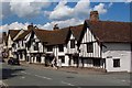
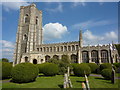
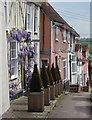
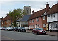
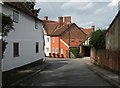
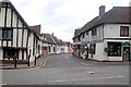
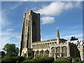
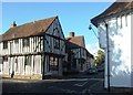

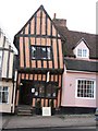
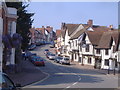
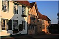
100 photos from this area
Area Information
Key information about the CO10 9PT including its size, population, and administrative classification.
- Area Type
- Postcode
- Area Size
- 1.8 hectares
- Population
- 1922
- Population Density
- 160 people/km²
House Prices in CO10 9PT
33
Properties
£292,600
Average Sold Price
£75,000
Lowest Price
£740,000
Highest Price
Showing 33 properties
| Address | Type | Beds | Baths | Last Sale Price | Last Sale Date | |
|---|---|---|---|---|---|---|
| 21 High Street, Lavenham, CO10 9PT | Terraced | 4 | 3 | £740,000 | Oct 2025 | |
| Moreton Cottage, 83 High Street, Lavenham, CO10 9PT | Terraced | 1 | 1 | £230,000 | Aug 2025 | |
| 81 High Street, Lavenham, CO10 9PT | Terraced | 1 | 1 | £240,000 | Nov 2023 | |
| 28 High Street, Lavenham, CO10 9PT | Terraced | 3 | 1 | £359,995 | Oct 2021 | |
| 27 High Street, Lavenham, CO10 9PT | Terraced | 3 | 2 | £350,000 | Dec 2019 | |
| Gable End, 29 High Street, Lavenham, CO10 9PT | Terraced | 3 | 2 | £535,000 | Jul 2019 | |
| 76 High Street, Lavenham, CO10 9PT | Terraced | 2 | - | £245,000 | Feb 2019 | |
| 89 High Street, Lavenham, CO10 9PT | Semi-detached | 4 | - | £588,000 | Oct 2018 | |
| 73 High Street, Lavenham, CO10 9PT | Terraced | 2 | 1 | £237,500 | Feb 2018 | |
| 75 High Street, Lavenham, CO10 9PT | Terraced | 2 | 1 | £225,000 | May 2017 |
Page 1 of 4
Energy Efficiency in CO10 9PT
Amenities
Schools
| Rank | School | Type | Entry gender | Ages |
|---|
Explore more schools in this area
Go to Schools tabDemographics
Household Size
One person
most common
Accommodation Type
Houses
most common
Tenure
65
majority
Ethnic Group
White
most common
Religion
N/A
most common
Household Composition
N/A
most common
Age
47
median
Adults (30-64 years)
most common
Household Deprivation
N/A
with no deprivation
NS-SEC
38
in Lower managerial occupations
Explore more demographic insights in this area
Go to Demographics tabPlanning
Planning Constraints
- Flood RiskPremium
- Ramsar Wetland SitesPremium
- Area of Outstanding Natural BeautyPremium
- Protected Nature ReservePremium
- Protected WoodlandPremium