Area Overview for CO10 9NJ
Photos of CO10 9NJ
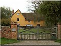
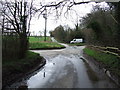
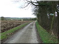
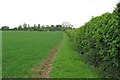
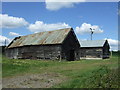
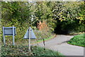
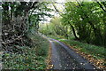
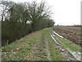
14 photos from this area
Area Information
Key information about the CO10 9NJ including its size, population, and administrative classification.
- Area Type
- Postcode
- Area Size
- 1.4 km²
- Population
- 2309
- Population Density
- 42 people/km²
House Prices in CO10 9NJ
9
Properties
£498,750
Average Sold Price
£150,000
Lowest Price
£800,000
Highest Price
Showing 9 properties
| Address | Type | Beds | Baths | Last Sale Price | Last Sale Date | |
|---|---|---|---|---|---|---|
| Barn Owl Lodge, Whelp Street, Preston St Mary, CO10 9NJ | Detached | 4 | - | £150,000 | Sep 2020 | |
| Dingle Dell, Whelp Street, Preston St Mary, CO10 9NJ | house | - | - | £625,000 | May 2018 | |
| Model Farm, Whelp Street, Preston St Mary, CO10 9NJ | Land | - | - | £420,000 | Apr 2018 | |
| Nova Scotia House, Nova Scotia Lane, Monks Eleigh, CO10 9NJ | Detached | 5 | - | £800,000 | Mar 2015 | |
| Swifts Manor, Whelp Street, Preston St Mary, CO10 9NJ | Land | - | - | - | - | |
| The Cottage, Nova Scotia Lane, Monks Eleigh, CO10 9NJ | Detached | - | - | - | - | |
| Swifts Manor Farm Riding Centre, Whelp Street, Preston St Mary, CO10 9NJ | Equestrian | - | - | - | - | |
| Swifts Manor Farm Ltd, Office At, Swifts Manor Farm Riding Centre, Whelp Street, Preston St Mary, CO10 9NJ | Office | - | - | - | - | |
| Carpenters Cottage, Whelp Street, Preston St Mary, CO10 9NJ | house | - | - | - | - |
Energy Efficiency in CO10 9NJ
Amenities
Schools
| Rank | School | Type | Entry gender | Ages |
|---|
Explore more schools in this area
Go to Schools tabDemographics
Household Size
Two person
most common
Accommodation Type
Houses
most common
Tenure
75
majority
Ethnic Group
White
most common
Religion
N/A
most common
Household Composition
N/A
most common
Age
47
median
Adults (30-64 years)
most common
Household Deprivation
N/A
with no deprivation
NS-SEC
41
in Lower managerial occupations
Explore more demographic insights in this area
Go to Demographics tabPlanning
Planning Constraints
- Flood RiskPremium
- Ramsar Wetland SitesPremium
- Area of Outstanding Natural BeautyPremium
- Protected Nature ReservePremium
- Protected WoodlandPremium