Area Overview for CO10 8AH
Photos of CO10 8AH
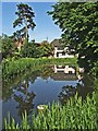
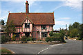
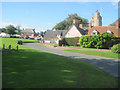
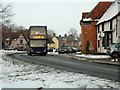
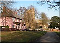
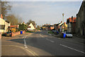
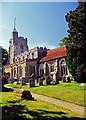
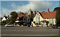
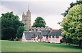
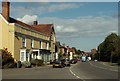
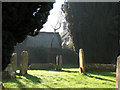
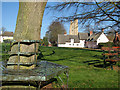
100 photos from this area
Area Information
Key information about the CO10 8AH including its size, population, and administrative classification.
- Area Type
- Postcode
- Area Size
- 2.3 hectares
- Population
- 1953
- Population Density
- 41 people/km²
House Prices in CO10 8AH
7
Properties
£356,825
Average Sold Price
£205,000
Lowest Price
£655,000
Highest Price
Showing 7 properties
| Address | Type | Beds | Baths | Last Sale Price | Last Sale Date | |
|---|---|---|---|---|---|---|
| Little Haven, Water Lane, Cavendish, CO10 8AH | house | 7 | 2 | £655,000 | Jul 2022 | |
| Maple House, Water Lane, Cavendish, CO10 8AH | Detached | 4 | 2 | £379,950 | Dec 2016 | |
| Sun Cottage, Water Lane, Cavendish, CO10 8AH | Detached | 4 | - | £320,000 | Mar 2013 | |
| Treetops, Water Lane, Cavendish, CO10 8AH | house | - | - | £342,000 | Oct 2009 | |
| Water Lane Cottage, Water Lane, Cavendish, CO10 8AH | Detached | - | - | £239,000 | Aug 2005 | |
| Plumstead House, Water Lane, Cavendish, CO10 8AH | Detached | - | - | £205,000 | Mar 2002 | |
| Brookside, Water Lane, Cavendish, CO10 8AH | Detached | - | - | - | - |
Energy Efficiency in CO10 8AH
Amenities
Schools
| Rank | School | Type | Entry gender | Ages |
|---|
Explore more schools in this area
Go to Schools tabDemographics
Household Size
Two person
most common
Accommodation Type
Houses
most common
Tenure
79
majority
Ethnic Group
White
most common
Religion
N/A
most common
Household Composition
N/A
most common
Age
47
median
Adults (30-64 years)
most common
Household Deprivation
N/A
with no deprivation
NS-SEC
41
in Lower managerial occupations
Explore more demographic insights in this area
Go to Demographics tabPlanning
Planning Constraints
- Flood RiskPremium
- Ramsar Wetland SitesPremium
- Area of Outstanding Natural BeautyPremium
- Protected Nature ReservePremium
- Protected WoodlandPremium