Area Overview for CO10 7QZ
Photos of CO10 7QZ
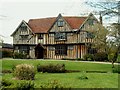
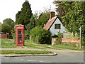
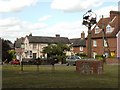
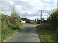
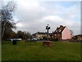
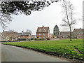
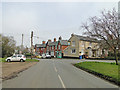
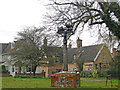
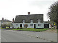
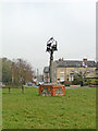
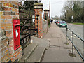
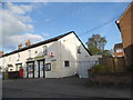
38 photos from this area
Area Information
Key information about the CO10 7QZ including its size, population, and administrative classification.
- Area Type
- Postcode
- Area Size
- 2.3 hectares
- Population
- 2348
- Population Density
- 226 people/km²
House Prices in CO10 7QZ
71
Properties
£158,188
Average Sold Price
£32,500
Lowest Price
£335,000
Highest Price
Showing 71 properties
| Address | Type | Beds | Baths | Last Sale Price | Last Sale Date | |
|---|---|---|---|---|---|---|
| 118 Kings Road, Glemsford, CO10 7QZ | Semi-detached | 3 | 1 | £245,000 | Mar 2024 | |
| 71 Kings Road, Glemsford, CO10 7QZ | Detached | 4 | 2 | £315,000 | Sep 2023 | |
| 120 Kings Road, Glemsford, CO10 7QZ | Semi-detached | 3 | 1 | £266,000 | Sep 2022 | |
| 84 Kings Road, Glemsford, CO10 7QZ | Retail | 3 | 2 | £335,000 | Jul 2022 | |
| 68 Kings Road, Glemsford, CO10 7QZ | Terraced | 3 | 1 | £264,500 | Jul 2022 | |
| 106 Kings Road, Glemsford, CO10 7QZ | house | - | - | £260,000 | Nov 2021 | |
| 75 Kings Road, Glemsford, CO10 7QZ | house | 4 | - | £250,000 | Jun 2021 | |
| 111 Kings Road, Glemsford, CO10 7QZ | Flat | 1 | 1 | £67,500 | Mar 2021 | |
| 121 Kings Road, Glemsford, CO10 7QZ | Semi-detached | 3 | 2 | £205,000 | Mar 2021 | |
| 77 Kings Road, Glemsford, CO10 7QZ | Bungalow | 3 | 1 | £275,000 | Dec 2020 |
Page 1 of 8
Energy Efficiency in CO10 7QZ
Amenities
Schools
| Rank | School | Type | Entry gender | Ages |
|---|
Explore more schools in this area
Go to Schools tabDemographics
Household Size
Two person
most common
Accommodation Type
Houses
most common
Tenure
82
majority
Ethnic Group
White
most common
Religion
N/A
most common
Household Composition
N/A
most common
Age
47
median
Adults (30-64 years)
most common
Household Deprivation
N/A
with no deprivation
NS-SEC
34
in Lower managerial occupations
Explore more demographic insights in this area
Go to Demographics tabPlanning
Planning Constraints
- Flood RiskPremium
- Ramsar Wetland SitesPremium
- Area of Outstanding Natural BeautyPremium
- Protected Nature ReservePremium
- Protected WoodlandPremium