Area Overview for CO10 7PH
Photos of CO10 7PH
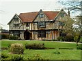
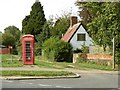
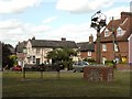
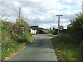
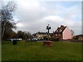
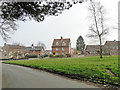
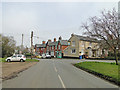
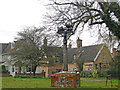
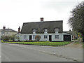
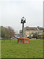
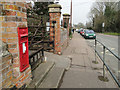
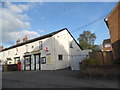
38 photos from this area
Area Information
Key information about the CO10 7PH including its size, population, and administrative classification.
- Area Type
- Postcode
- Area Size
- 1.4 hectares
- Population
- 2348
- Population Density
- 226 people/km²
House Prices in CO10 7PH
32
Properties
£165,434
Average Sold Price
£65,000
Lowest Price
£336,250
Highest Price
Showing 32 properties
| Address | Type | Beds | Baths | Last Sale Price | Last Sale Date | |
|---|---|---|---|---|---|---|
| 19 Fair Green, Glemsford, CO10 7PH | Terraced | 3 | 1 | £336,250 | Jul 2025 | |
| 27 Fair Green, Glemsford, CO10 7PH | Terraced | 2 | 1 | £243,000 | Jun 2025 | |
| 38 Fair Green, Glemsford, CO10 7PH | Terraced | 2 | - | £239,000 | Mar 2023 | |
| 36 Fair Green, Glemsford, CO10 7PH | Terraced | 3 | 1 | £250,000 | Jan 2023 | |
| 44 Fair Green, Glemsford, CO10 7PH | house | - | - | £267,500 | Oct 2022 | |
| 16 Fair Green, Glemsford, CO10 7PH | house | - | - | £195,000 | Jan 2021 | |
| 18 Fair Green, Glemsford, CO10 7PH | house | 2 | - | £237,000 | Jun 2017 | |
| 32 Fair Green, Glemsford, CO10 7PH | house | - | - | £149,500 | Apr 2015 | |
| 17 Fair Green, Glemsford, CO10 7PH | Semi-detached | 3 | - | £165,000 | Jul 2013 | |
| 12 Fair Green, Glemsford, CO10 7PH | house | 3 | 1 | £97,000 | Mar 2010 |
Page 1 of 4
Energy Efficiency in CO10 7PH
Amenities
Schools
| Rank | School | Type | Entry gender | Ages |
|---|
Explore more schools in this area
Go to Schools tabDemographics
Household Size
Two person
most common
Accommodation Type
Houses
most common
Tenure
82
majority
Ethnic Group
White
most common
Religion
N/A
most common
Household Composition
N/A
most common
Age
47
median
Adults (30-64 years)
most common
Household Deprivation
N/A
with no deprivation
NS-SEC
34
in Lower managerial occupations
Explore more demographic insights in this area
Go to Demographics tabPlanning
Planning Constraints
- Flood RiskPremium
- Ramsar Wetland SitesPremium
- Area of Outstanding Natural BeautyPremium
- Protected Nature ReservePremium
- Protected WoodlandPremium