Area Overview for CO10 7NT
Photos of CO10 7NT

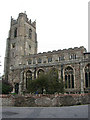
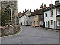
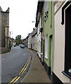
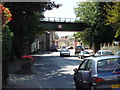
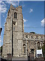
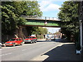
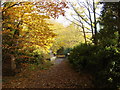
76 photos from this area
Area Information
Key information about the CO10 7NT including its size, population, and administrative classification.
- Area Type
- Postcode
- Area Size
- 6927 m²
- Population
- 1567
- Population Density
- 448 people/km²
House Prices in CO10 7NT
30
Properties
£162,069
Average Sold Price
£45,000
Lowest Price
£265,000
Highest Price
Showing 30 properties
| Address | Type | Beds | Baths | Last Sale Price | Last Sale Date | |
|---|---|---|---|---|---|---|
| 36 Middleton Road, Sudbury, CO10 7NT | house | - | - | £265,000 | Mar 2023 | |
| 30 Middleton Road, Sudbury, CO10 7NT | house | - | - | £220,000 | Apr 2022 | |
| 52 Middleton Road, Sudbury, CO10 7NT | house | - | - | £230,000 | Feb 2022 | |
| 56 Middleton Road, Sudbury, CO10 7NT | Terraced | 3 | 1 | £230,000 | Dec 2021 | |
| 66 Middleton Road, Sudbury, CO10 7NT | house | 3 | 1 | £230,000 | Aug 2021 | |
| 54 Middleton Road, Sudbury, CO10 7NT | Terraced | 3 | 1 | £235,000 | Jun 2021 | |
| 68 Middleton Road, Sudbury, CO10 7NT | Terraced | 3 | 1 | £200,000 | Feb 2018 | |
| 32 Middleton Road, Sudbury, CO10 7NT | Terraced | 3 | 1 | £237,000 | Jul 2017 | |
| 34 Middleton Road, Sudbury, CO10 7NT | Terraced | 3 | 1 | £200,000 | Dec 2016 | |
| 46 Middleton Road, Sudbury, CO10 7NT | house | - | - | £145,000 | Sep 2012 |
Page 1 of 3
Energy Efficiency in CO10 7NT
Amenities
Schools
| Rank | School | Type | Entry gender | Ages |
|---|
Explore more schools in this area
Go to Schools tabDemographics
Household Size
Two person
most common
Accommodation Type
Houses
most common
Tenure
71
majority
Ethnic Group
White
most common
Religion
N/A
most common
Household Composition
N/A
most common
Age
47
median
Adults (30-64 years)
most common
Household Deprivation
N/A
with no deprivation
NS-SEC
34
in Lower managerial occupations
Explore more demographic insights in this area
Go to Demographics tabPlanning
Planning Constraints
- Flood RiskPremium
- Ramsar Wetland SitesPremium
- Area of Outstanding Natural BeautyPremium
- Protected Nature ReservePremium
- Protected WoodlandPremium