Area Overview for CO10 7JN
Photos of CO10 7JN
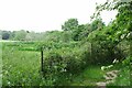
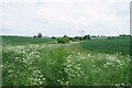

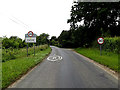
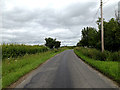

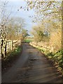
16 photos from this area
Area Information
Key information about the CO10 7JN including its size, population, and administrative classification.
- Area Type
- Postcode
- Area Size
- 58.0 hectares
- Population
- 2287
- Population Density
- 36 people/km²
House Prices in CO10 7JN
13
Properties
£327,333
Average Sold Price
£215,000
Lowest Price
£515,000
Highest Price
Showing 13 properties
| Address | Type | Beds | Baths | Last Sale Price | Last Sale Date | |
|---|---|---|---|---|---|---|
| 3-4, School Barn Cottages, School Road, Pentlow, CO10 7JN | house | 3 | 1 | £252,000 | Jun 2025 | |
| The Coach House, School Road, Pentlow, CO10 7JN | Detached | - | - | £515,000 | Dec 2019 | |
| Rectory Lodge, School Road, Pentlow, CO10 7JN | Detached | - | - | £215,000 | Aug 1999 | |
| Pentlow Tower, School Road, Pentlow, CO10 7JN | Terraced | 1 | 1 | - | - | |
| School Barn Farm, School Barn Farm, Pentlow, CO10 7JN | Detached | 3 | 2 | - | - | |
| 1-2, Gable End, School Barn Cottages, School Road, Pentlow, CO10 7JN | Terraced | - | - | - | - | |
| Foot Of The Folly, School Barn Farm, Pentlow, CO10 7JN | Bungalow | - | - | - | - | |
| Caravan, Foot Of The Folly, School Barn Farm, Pentlow, CO10 7JN | Mobile Home | - | - | - | - | |
| West Bungalow, School Barn Farm, Pentlow, CO10 7JN | Bungalow | - | - | - | - | |
| Market Stall 1, Foot Of The Folly, School Barn Farm, Pentlow, CO10 7JN | Retail | - | - | - | - |
Page 1 of 2
Energy Efficiency in CO10 7JN
Amenities
Schools
| Rank | School | Type | Entry gender | Ages |
|---|
Explore more schools in this area
Go to Schools tabDemographics
Household Size
Two person
most common
Accommodation Type
Houses
most common
Tenure
76
majority
Ethnic Group
White
most common
Religion
N/A
most common
Household Composition
N/A
most common
Age
47
median
Adults (30-64 years)
most common
Household Deprivation
N/A
with no deprivation
NS-SEC
40
in Lower managerial occupations
Explore more demographic insights in this area
Go to Demographics tabPlanning
Planning Constraints
- Flood RiskPremium
- Ramsar Wetland SitesPremium
- Area of Outstanding Natural BeautyPremium
- Protected Nature ReservePremium
- Protected WoodlandPremium