Area Overview for CO10 5EE
Photos of CO10 5EE
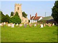
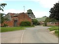
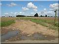
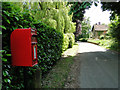
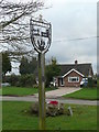
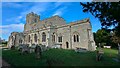
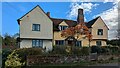
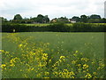
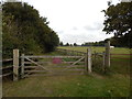
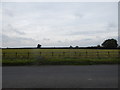
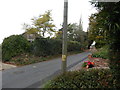
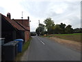
63 photos from this area
Area Information
Key information about the CO10 5EE including its size, population, and administrative classification.
- Area Type
- Postcode
- Area Size
- 67.7 hectares
- Population
- 2382
- Population Density
- 80 people/km²
House Prices in CO10 5EE
43
Properties
£424,556
Average Sold Price
£207,000
Lowest Price
£745,000
Highest Price
Showing 43 properties
| Address | Type | Beds | Baths | Last Sale Price | Last Sale Date | |
|---|---|---|---|---|---|---|
| 1 Groton Street, Edwardstone, CO10 5EE | Detached | 4 | - | £425,000 | Feb 2024 | |
| Ivy Cottage, Groton Street, Groton, CO10 5EE | house | 2 | 2 | £470,000 | Aug 2023 | |
| Crown House, Groton Street, Groton, CO10 5EE | Detached | 3 | 2 | £720,000 | Jan 2023 | |
| 2 Groton Street, Edwardstone, CO10 5EE | house | - | - | £278,000 | Jan 2023 | |
| 8 Groton Street, Edwardstone, CO10 5EE | house | - | - | £350,000 | Sep 2022 | |
| Waterside Barn, Groton Street, Groton, CO10 5EE | Detached | 4 | 2 | £725,000 | Nov 2020 | |
| Knoll House, Groton Street, Groton, CO10 5EE | Detached | 4 | 2 | £547,500 | Oct 2019 | |
| The New Bungalow, Groton Street, Edwardstone, CO10 5EE | Detached | 4 | 2 | £268,000 | Aug 2018 | |
| Tanners Farm, Groton Street, Groton, CO10 5EE | house | - | - | £745,000 | Aug 2018 | |
| Mulberry House, Groton Street, Groton, CO10 5EE | Detached | 4 | 2 | £490,000 | Sep 2017 |
Page 1 of 5
Energy Efficiency in CO10 5EE
Amenities
Schools
| Rank | School | Type | Entry gender | Ages |
|---|
Explore more schools in this area
Go to Schools tabDemographics
Household Size
Two person
most common
Accommodation Type
Houses
most common
Tenure
76
majority
Ethnic Group
White
most common
Religion
N/A
most common
Household Composition
N/A
most common
Age
47
median
Adults (30-64 years)
most common
Household Deprivation
N/A
with no deprivation
NS-SEC
43
in Lower managerial occupations
Explore more demographic insights in this area
Go to Demographics tabPlanning
Planning Constraints
- Flood RiskPremium
- Ramsar Wetland SitesPremium
- Area of Outstanding Natural BeautyPremium
- Protected Nature ReservePremium
- Protected WoodlandPremium