Area Overview for CO10 0JL
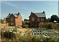
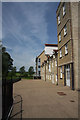
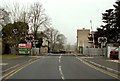
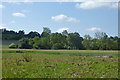
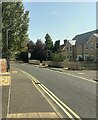
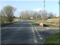
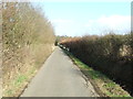
Photos of CO10 0JL
Area Information
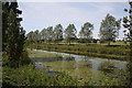
Living in CO10 0JL offers a specific postcode-defined residential cluster that defines life in Great Cornard. This small area covers just 9,553 square metres and serves a population of 2,184 people. The settlement sits within the Babergh District of Suffolk, bordering Sudbury to the south and lying separated from Essex by the River Stour. Historical records indicate this location was first mentioned as Cornierda in the Domesday Book of 1086, evolving from a rural parish into a modern residential neighbourhood. The name Great Cornard reflects its Old English roots meaning great corn enclosure, highlighting the site's agricultural past. Today, the village characterises rolling countryside and a picturesque setting that blends historical charm with contemporary living. Residents enjoy quintessential English village life alongside scenic walks along the River Stour and visits to historic churches. The parish church of St Andrew features architectural elements from various periods, while Great Cornard Country Park remains a key feature owned by the parish council. Cornard Wood, depicted in Thomas Gainsborough's 1748 painting, sits near the village outskirts. You can explore the area by foot or bicycle via the available walking trails and country lanes. Sudbury acts as the nearest major transport hub, providing access to rail links for the wider commute.
- Area Type
- Postcode
- Area Size
- 9553 m²
- Population
- 2184
- Population Density
- 2402 people/km²
Homes in CO10 0JL form a market defined by traditional ownership patterns and specific housing typologies. The accommodation type data confirms that houses are the primary dwelling style within this postcode area. This structural fact distinguishes the location from urban districts dominated by flats or maisonettes. With 72 per cent of residents owning their homes, the area functions primarily as a settled residential zone rather than a rental market dominated by short-term tenancies. This statistic indicates that the vast majority of properties are owner-occupied, likely including both private residences and the council estate sections developed at Prospect Hill in the 1930s. The low property density of 9,553 square metres hosting 2,184 people suggests that every square metre of land is actively utilized for housing. Buyers seeking entry into this market should anticipate competing with established owners who have maintained their properties for decades. The prevalence of houses aligns with the village character of Great Cornard, where detached or semi-detached structures are standard. This market composition means transaction activities often involve family transfers or upgrades rather than high-frequency student or short-let turnovers.
House Prices in CO10 0JL
Showing 25 properties
| Address | Type | Beds | Baths | Last Sale Price | Last Sale Date | |
|---|---|---|---|---|---|---|
| 12 Perryfield, Great Cornard, CO10 0JL | Maisonette | 2 | 1 | £91,000 | Jan 2025 | |
| 13 Perryfield, Great Cornard, CO10 0JL | Flat | 2 | - | £160,000 | Nov 2023 | |
| 3 Perryfield, Great Cornard, CO10 0JL | house | - | - | £245,000 | Oct 2021 | |
| 16 Perryfield, Great Cornard, CO10 0JL | Flat | 2 | - | £162,500 | May 2021 | |
| 25 Perryfield, Great Cornard, CO10 0JL | house | - | - | £207,000 | Dec 2020 | |
| 1 Perryfield, Great Cornard, CO10 0JL | Terraced | 3 | 1 | £205,000 | Nov 2018 | |
| 14 Perryfield, Great Cornard, CO10 0JL | Maisonette | 2 | - | £120,000 | Aug 2014 | |
| 24 Perryfield, Great Cornard, CO10 0JL | Terraced | 3 | - | £155,000 | Apr 2014 | |
| 23 Perryfield, Great Cornard, CO10 0JL | Terraced | 3 | - | £152,000 | Jan 2014 | |
| 17 Perryfield, Great Cornard, CO10 0JL | Maisonette | 2 | 1 | £105,000 | Nov 2013 |
Energy Efficiency in CO10 0JL
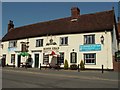
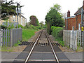
Your daily routine in CO10 0JL benefits from the proximity of specific retail and transport amenities within practical reach. Five key retail locations serve the neighbourhood, including Co-op Cornard, East of England Co-operative Co, and Morrisons Daily. These venues provide essential grocery shopping and daily necessities without requiring long journeys into Sudbury. For transport, three rail options are accessible, notably Sudbury Railway Station, Entrance, and Bures Railway Station. Having access to Sudbury Railway Station places you within commuting distance of London and other major urban centres. The village character is further enhanced by Great Cornard Country Park, which offers formal leisure space. Local choices include historic churches and traditional pubs that contribute to the area's atmosphere. You can access these facilities easily on foot or by bicycle along the country lanes. The combination of supermarkets and rail links creates a balanced lifestyle where you do not need a car for every errand. Shopping for fresh produce at Co-op Cornard or the Co-operative branch is a small task completed near your home.
Amenities
Schools
Families considering CO10 0JL have access to a specific group of educational institutions within a practical reach of the postcode. The local education landscape includes Wells Hall Community Primary School, which operates as a primary institution with a good Ofsted rating. Thomas Gainsborough School also serves the immediate vicinity as a primary school, distinguished by an outstanding Ofsted rating and academy status. Another option for younger students is Great Cornard Middle School, which functions as a primary school within the local catchment. Parents have continuity of education within these facilities, allowing children to transition through different educational stages without relocating. The presence of both community and academy structures provides diverse funding models and teaching philosophies within the same neighbourhood. Thomas Gainsborough School stands out with its outstanding recognition, potentially offering higher academic standards compared to its peers. Wells Hall Primary School complements this with a solid good rating. This mix of ratings and types means you can select a school based on specific educational values or performance metrics without needing to commute far. The availability of primary education alongside the middle school stage supports families with children from early years through to adolescence within the village boundaries.
| Rank | School | Type | Entry gender | Ages |
|---|
Explore more schools in this area
Go to Schools tabDemographics
The community profile in CO10 0JL presents a relatively mature population structure. The median age stands at 47 years, with the most common age range falling between 30 and 64 years old. This demographic skew reflects the nature of the accommodation type, which consists predominantly of houses rather than high-density flats. A significant majority of residents, specifically 72 per cent, are in a state of home ownership. This high rate of ownership suggests a stable, long-term community where families and couples have established roots. The predominant ethnic group is White, mirroring the traditional demographic fabric of many Suffolk villages. With a total population of 2,184 spread across less than three hectares, the density is considerable for a rural-style setting. The area attracts adults seeking independence from a single-occupancy lifestyle. The high homeownership rate implies that most dwellers have invested in property upkeep and community integration over a long period. This stability often correlates with lower transient rates and stronger local social bonds compared to commuter belts or student hubs.
Household Size
Accommodation Type
Tenure
Ethnic Group
Religion
Household Composition
Age
Household Deprivation
NS-SEC
Explore more demographic insights in this area
Go to Demographics tabPlanning
Planning Constraints
- Flood RiskPremium
- Ramsar Wetland SitesPremium
- Area of Outstanding Natural BeautyPremium
- Protected Nature ReservePremium
- Protected WoodlandPremium