Area Overview for CO1 2SF
Photos of CO1 2SF
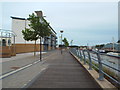
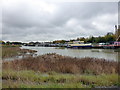
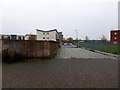

71 photos from this area
Area Information
Key information about the CO1 2SF including its size, population, and administrative classification.
- Area Type
- Postcode
- Area Size
- 9303 m²
- Population
- 1629
- Population Density
- 5688 people/km²
House Prices in CO1 2SF
14
Properties
£117,727
Average Sold Price
£60,000
Lowest Price
£235,000
Highest Price
Showing 14 properties
| Address | Type | Beds | Baths | Last Sale Price | Last Sale Date | |
|---|---|---|---|---|---|---|
| 210 Greenstead Road, Colchester, CO1 2SF | Semi-detached | 5 | 2 | £235,000 | Apr 2021 | |
| 214 Greenstead Road, Colchester, CO1 2SF | Terraced | 4 | 1 | £220,000 | Sep 2018 | |
| 212 Greenstead Road, Colchester, CO1 2SF | Bungalow | 1 | 1 | £199,995 | Jul 2016 | |
| 218 Greenstead Road, Colchester, CO1 2SF | Terraced | 4 | - | £120,000 | Nov 2003 | |
| 234 Greenstead Road, Colchester, CO1 2SF | house | 2 | 1 | £60,000 | Jul 2003 | |
| 236 Greenstead Road, Colchester, CO1 2SF | house | - | - | £60,000 | Jul 2002 | |
| 232 Greenstead Road, Colchester, CO1 2SF | house | - | - | £60,000 | Jul 2002 | |
| 228 Greenstead Road, Colchester, CO1 2SF | house | - | - | £85,000 | Jul 2002 | |
| 230 Greenstead Road, Colchester, CO1 2SF | house | - | - | £85,000 | Jul 2002 | |
| 216 Greenstead Road, Colchester, CO1 2SF | house | 3 | 1 | £87,000 | Mar 2002 |
Page 1 of 2
Energy Efficiency in CO1 2SF
Amenities
Schools
| Rank | School | Type | Entry gender | Ages |
|---|
Explore more schools in this area
Go to Schools tabDemographics
Household Size
Family (3-5 people)
most common
Accommodation Type
Houses
most common
Tenure
25
majority
Ethnic Group
White
most common
Religion
N/A
most common
Household Composition
N/A
most common
Age
22
median
Young Adults (15-29 years)
most common
Household Deprivation
N/A
with no deprivation
NS-SEC
12
in Lower managerial occupations
Explore more demographic insights in this area
Go to Demographics tabPlanning
Planning Constraints
- Flood RiskPremium
- Ramsar Wetland SitesPremium
- Area of Outstanding Natural BeautyPremium
- Protected Nature ReservePremium
- Protected WoodlandPremium