Area Overview for CM9 8TF
Photos of CM9 8TF

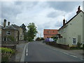
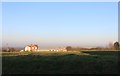
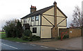
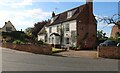
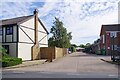
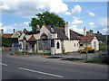
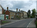

11 photos from this area
Area Information
Key information about the CM9 8TF including its size, population, and administrative classification.
- Area Type
- Postcode
- Area Size
- 2.1 hectares
- Population
- 1628
- Population Density
- 106 people/km²
House Prices in CM9 8TF
17
Properties
£318,350
Average Sold Price
£114,000
Lowest Price
£650,000
Highest Price
Showing 17 properties
| Address | Type | Beds | Baths | Last Sale Price | Last Sale Date | |
|---|---|---|---|---|---|---|
| Elder House, 7 North Street, Tolleshunt Darcy, CM9 8TF | Detached | 4 | - | £650,000 | Oct 2022 | |
| Baccara, 8 North Street, Tolleshunt Darcy, CM9 8TF | house | - | - | £372,500 | Jun 2021 | |
| Campions Lodge, North Street, Tolleshunt Darcy, CM9 8TF | Bungalow | - | - | £427,500 | May 2021 | |
| Keebles, 3 North Street, Tolleshunt Darcy, CM9 8TF | Detached | 3 | - | £347,500 | Mar 2021 | |
| 5A North Street, Tolleshunt Darcy, CM9 8TF | Detached | 3 | 1 | £267,000 | Jan 2017 | |
| 1A North Street, Tolleshunt Darcy, CM9 8TF | Detached | 4 | - | £310,000 | Mar 2015 | |
| 5 North Street, Tolleshunt Darcy, CM9 8TF | house | - | - | £155,000 | Jun 2004 | |
| The Old Bakery, 11 North Street, Tolleshunt Darcy, CM9 8TF | Terraced | - | - | £365,000 | Jul 2002 | |
| Granary Lodge, 4A North Street, Tolleshunt Darcy, CM9 8TF | Detached | - | - | £175,000 | Jul 2002 | |
| Magpies, 6 North Street, Tolleshunt Darcy, CM9 8TF | Detached | - | - | £114,000 | Jul 2000 |
Page 1 of 2
Energy Efficiency in CM9 8TF
Amenities
Schools
| Rank | School | Type | Entry gender | Ages |
|---|
Explore more schools in this area
Go to Schools tabDemographics
Household Size
Two person
most common
Accommodation Type
Houses
most common
Tenure
72
majority
Ethnic Group
White
most common
Religion
N/A
most common
Household Composition
N/A
most common
Age
47
median
Adults (30-64 years)
most common
Household Deprivation
N/A
with no deprivation
NS-SEC
33
in Lower managerial occupations
Explore more demographic insights in this area
Go to Demographics tabPlanning
Planning Constraints
- Flood RiskPremium
- Ramsar Wetland SitesPremium
- Area of Outstanding Natural BeautyPremium
- Protected Nature ReservePremium
- Protected WoodlandPremium