Area Overview for CM9 5DD
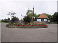
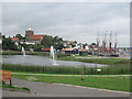
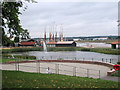
Photos of CM9 5DD


Area Information
Living in CM9 5DD, a small residential cluster in Essex, offers a blend of historical charm and practical modernity. Nestled in the Maldon District, this area sits on the south bank of the Blackwater Estuary, a location with Saxon origins that once served as a regional trade hub. The postcode covers 7,686 square metres, housing 2,500 residents at a density of 723 people per square kilometre. This compact community feels both intimate and connected, with a median age of 47 and a population skewed toward adults aged 30–64. Daily life here balances the quietude of a historic town with proximity to practical amenities. Maldon’s heritage, including its Anglo-Saxon roots and 12th-century churches, adds cultural depth, while the area’s modern infrastructure ensures convenience. Residents benefit from nearby rail links, retail options, and a primary school with a good Ofsted rating. The area’s small size fosters a sense of familiarity, though its limited housing stock means opportunities for expansion are constrained. For those seeking a settled, community-focused lifestyle with a touch of history, CM9 5DD provides a distinct alternative to larger urban centres.
- Area Type
- Postcode
- Area Size
- 7686 m²
- Population
- 2500
- Population Density
- 723 people/km²
The property market in CM9 5DD is characterised by a 56% home ownership rate, with houses forming the predominant accommodation type. This suggests a market skewed toward owner-occupied properties rather than rental housing, which may limit options for buyers seeking investment opportunities or tenants. The small area size of 7,686 square metres and a population of 2,500 residents imply a limited housing stock, potentially increasing competition for available properties. The focus on houses rather than flats or apartments may appeal to those prioritising space and privacy, though it could also mean fewer options for first-time buyers or those seeking smaller homes. The area’s proximity to rail stations and retail amenities may enhance its desirability, but the lack of detailed data on property prices or recent market trends means buyers must consider the limited supply and potential for constrained growth. For those seeking a stable, owner-occupied home in a historic setting, CM9 5DD offers a niche market with distinct advantages.
House Prices in CM9 5DD
Showing 31 properties
| Address | Type | Beds | Baths | Last Sale Price | Last Sale Date | |
|---|---|---|---|---|---|---|
| 145 Wantz Road, Maldon, CM9 5DD | Semi-detached | 2 | 1 | £294,000 | Oct 2025 | |
| 129 Wantz Road, Maldon, CM9 5DD | house | 2 | 1 | £243,000 | Sep 2025 | |
| 135 Wantz Road, Maldon, CM9 5DD | Terraced | 2 | 1 | £250,000 | Sep 2025 | |
| 163 Wantz Road, Maldon, CM9 5DD | house | 6 | 3 | £672,500 | Sep 2021 | |
| 175 Wantz Road, Maldon, CM9 5DD | house | - | - | £289,950 | Sep 2021 | |
| 169 Wantz Road, Maldon, CM9 5DD | house | 2 | - | £278,000 | Mar 2021 | |
| 131 Wantz Road, Maldon, CM9 5DD | Terraced | 2 | 1 | £235,000 | Jan 2021 | |
| 167 Wantz Road, Maldon, CM9 5DD | Semi-detached | 2 | - | £295,000 | Jan 2019 | |
| 137 Wantz Road, Maldon, CM9 5DD | Terraced | 2 | 1 | £200,000 | Aug 2017 | |
| 97 Wantz Road, Maldon, CM9 5DD | house | - | - | £155,000 | Jan 2016 |
Energy Efficiency in CM9 5DD
The lifestyle in CM9 5DD is shaped by its proximity to retail and transport hubs. Within practical reach, residents have access to five retail venues, including East of England Co-operative Co, Iceland Maldon, and M&S Maldon SF. These shops provide a range of everyday essentials, from groceries to general retail, supporting a self-contained shopping experience. The area’s rail stations—Hatfield Peverel, North Fambridge, and Witham—offer easy access to broader regional networks, facilitating travel for work, leisure, or socialising. While the data does not specify parks or leisure facilities, the historical context of Maldon suggests potential for cultural or heritage sites nearby. The combination of retail options and rail connectivity ensures a convenient daily life, with minimal need to travel far for basic needs. The compact nature of the area fosters a sense of community, where local amenities and transport links work together to create a functional, accessible environment.
Amenities
Schools
The nearest school to CM9 5DD is Maldon Primary School, a primary institution with a good Ofsted rating. This single school serves the area’s primary education needs, though no secondary schools are listed in the data. The presence of a well-rated primary school is a significant draw for families, offering a foundation for early education in a community with a median age of 47. The school’s rating suggests it meets or exceeds national standards, which could be a deciding factor for parents prioritising quality education. However, the absence of secondary school options within the area may require families to consider commuting to nearby towns for higher education. The school’s location within practical reach of residents underscores its accessibility, reinforcing the area’s appeal for those with children. For families, the availability of a good primary school adds to the practical advantages of living in CM9 5DD.
| Rank | School | Type | Entry gender | Ages |
|---|
Explore more schools in this area
Go to Schools tabDemographics
The community in CM9 5DD is predominantly composed of adults aged 30–64, with a median age of 47. This suggests a mature, stable population, likely with established careers and families. Home ownership rates stand at 56%, indicating a mix of long-term residents and those who have chosen to settle in the area. The accommodation type is primarily houses, reflecting a preference for standalone properties over flats or apartments. The predominant ethnic group is White, though specific data on diversity or deprivation is not provided. The population density of 723 people per square kilometre implies a moderately compact living environment, which may influence social dynamics and access to shared resources. The absence of detailed information on income levels or deprivation means that while the area appears to have a cohesive, middle-aged demographic, broader socioeconomic factors remain unexplored. This profile suggests a community focused on stability, with a strong emphasis on home ownership and traditional housing.
Household Size
Accommodation Type
Tenure
Ethnic Group
Religion
Household Composition
Age
Household Deprivation
NS-SEC
Explore more demographic insights in this area
Go to Demographics tabPlanning
Planning Constraints
- Flood RiskPremium
- Ramsar Wetland SitesPremium
- Area of Outstanding Natural BeautyPremium
- Protected Nature ReservePremium
- Protected WoodlandPremium