Area Overview for CM9 4EL
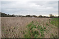
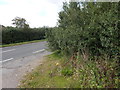
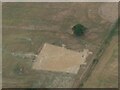
Photos of CM9 4EL


Area Information
CM9 4EL is a small, residential postcode area in Essex, encompassing a cluster of homes within the village of Great Totham. With a population of 2158 spread across 14.6 hectares, it offers a low-density, community-oriented lifestyle. The area is positioned between Chelmsford and Colchester, blending rural tranquillity with practical connectivity. Residents benefit from proximity to Great Totham’s historical landmarks, including St Peter’s Church and the Honywood School, built in 1857. The village’s compact size means amenities and services are within easy reach, while the surrounding countryside provides open space. The area’s demographic profile—primarily adults aged 30-64, with 86% owning their homes—suggests a stable, family-focused community. For those seeking a balance between seclusion and accessibility, CM9 4EL’s mix of historic character and modern conveniences makes it a compelling choice.
- Area Type
- Postcode
- Area Size
- 14.6 hectares
- Population
- 2158
- Population Density
- 76 people/km²
The property market in CM9 4EL is dominated by owner-occupied homes, with 86% of residents living in properties they own. The area’s housing stock consists primarily of houses, which are well-suited to families and those seeking spacious, private living. Given the small size of the postcode area, the number of available homes is limited, making it a niche market for buyers. The high home ownership rate suggests strong local attachment and a lack of rental demand, which may influence property values and availability. For prospective buyers, this means a focus on existing homes rather than new developments. The presence of established housing also implies a stable market with potential for long-term appreciation, though the limited inventory may require flexibility in location or property type.
House Prices in CM9 4EL
Showing 16 properties
| Address | Type | Beds | Baths | Last Sale Price | Last Sale Date | |
|---|---|---|---|---|---|---|
| 3 Chaffinch Gardens, Heybridge, CM9 4EL | house | - | - | - | - | |
| 6 Chaffinch Gardens, Heybridge, CM9 4EL | house | - | - | - | - | |
| 11 Chaffinch Gardens, Heybridge, CM9 4EL | house | - | - | - | - | |
| 12 Chaffinch Gardens, Heybridge, CM9 4EL | house | - | - | - | - | |
| 4 Chaffinch Gardens, Heybridge, CM9 4EL | Maisonette | - | - | - | - | |
| 13 Chaffinch Gardens, Heybridge, CM9 4EL | house | - | - | - | - | |
| 9 Chaffinch Gardens, Heybridge, CM9 4EL | house | - | - | - | - | |
| 7 Chaffinch Gardens, Heybridge, CM9 4EL | house | - | - | - | - | |
| 1 Chaffinch Gardens, Heybridge, CM9 4EL | house | - | - | - | - | |
| 8 Chaffinch Gardens, Heybridge, CM9 4EL | house | - | - | - | - |
Energy Efficiency in CM9 4EL
The lifestyle in CM9 4EL is shaped by its proximity to practical amenities. Within reach are five retail outlets, including East of England Co-operative Co and Asda Heybridge, offering everyday shopping needs. The two railway stations provide access to public transport, facilitating travel to nearby towns and cities. While the area does not list parks or leisure facilities explicitly, its small village setting suggests a mix of open spaces and community hubs. The presence of multiple churches, including St Peter’s Church and the United Reformed Church, adds to the area’s social fabric. This blend of retail, transport, and historical sites creates a convenient, low-stress environment where daily life can be efficiently managed without leaving the immediate vicinity.
Amenities
Schools
The primary school nearest to CM9 4EL is Great Totham Primary School, which holds an Ofsted rating of ‘good’. This school serves the local community and is likely a key factor for families considering the area. As the only named school in the data, it underscores the importance of education in shaping the area’s appeal. The absence of secondary schools or other educational institutions within the immediate vicinity suggests that residents may need to travel to nearby towns for higher education. However, the quality of the primary school provides a solid foundation for children’s early learning and could be a decisive factor for families prioritising strong local schooling.
| Rank | School | Type | Entry gender | Ages |
|---|
Explore more schools in this area
Go to Schools tabDemographics
The population of CM9 4EL has a median age of 47, with the majority of residents aged 30-64. This indicates a mature, established community with a strong presence of families and professionals. Home ownership is high at 86%, reflecting a preference for long-term residency over rental properties. The area is predominantly composed of houses, which aligns with the demographic’s need for family-friendly living spaces. The predominant ethnic group is White, and the data does not indicate significant diversity beyond this. The low population density of 76 people per square kilometre suggests a spread-out, less congested environment. This profile supports a lifestyle characterised by stability and a focus on local ties, with residents likely prioritising community engagement and long-term investment in their homes.
Household Size
Accommodation Type
Tenure
Ethnic Group
Religion
Household Composition
Age
Household Deprivation
NS-SEC
Explore more demographic insights in this area
Go to Demographics tabPlanning
Planning Constraints
- Flood RiskPremium
- Ramsar Wetland SitesPremium
- Area of Outstanding Natural BeautyPremium
- Protected Nature ReservePremium
- Protected WoodlandPremium