Area Overview for CM8 3UY
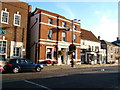
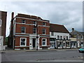
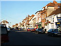
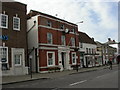
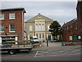
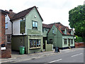
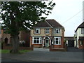
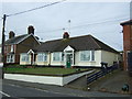
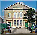
Photos of CM8 3UY

Area Information
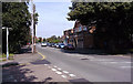
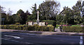
Living in CM8 3UY means residing in a tightly knit residential cluster in the heart of Witham, Essex. The area covers 7,714 square metres and is home to 1,564 people, translating to a dense population of 1,411 per square kilometre. This compact postcode is steeped in history, lying along the ancient Roman road between Chelmsford and Colchester. Daily life here balances modern convenience with historical roots, from the Saxon settlement of Chipping Hill to the 13th-century market granted by King John. The area’s small size means amenities and services are within easy reach, while its location on the A12 route ensures connectivity to nearby towns. Witham’s character is defined by its churches, including the Grade II-listed Holy Family and All Saints Catholic Church, and its proximity to the Cressing Temple, a site linked to the Knights Templar. This is a place where history and contemporary living coexist, offering a quiet, community-focused lifestyle for those seeking a balance between tradition and practicality.
- Area Type
- Postcode
- Area Size
- 7714 m²
- Population
- 1564
- Population Density
- 1411 people/km²
The property market in CM8 3UY is characterised by a 51% home ownership rate, with houses forming the predominant accommodation type. This suggests a largely owner-occupied area, though the small size of the postcode means the housing stock is limited. The focus on houses rather than flats or apartments indicates a preference for family-friendly or semi-detached living. Given the compact nature of the area, buyers should consider the proximity to local amenities and transport links as critical factors. The high population density of 1,411 per square kilometre means the housing stock is closely packed, which could affect property values and availability. For those seeking a home here, the market is likely to be competitive, with limited options for new builds or larger properties. The area’s small size also means that immediate surroundings, such as nearby towns, may offer more diverse housing choices.
House Prices in CM8 3UY
No properties found in this postcode.
Energy Efficiency in CM8 3UY
The lifestyle in CM8 3UY is shaped by its proximity to retail and transport hubs. Within the area, residents have access to five retail outlets, including Tesco Witham and Morrisons Daily, ensuring everyday shopping needs are met. The railway stations—Witham, Hatfield Peverel, and White Notley—offer regular services to nearby towns, making it easy to access larger centres for leisure, dining, and cultural activities. While the area itself is small, its location on the A12 route connects it to broader networks. The compact nature of the postcode means amenities are within walking or short driving distance, fostering a convenient, community-focused lifestyle. However, the absence of parks or leisure facilities within the postcode suggests that residents may need to venture slightly further for outdoor recreation or larger retail experiences.
Amenities
Schools
The only school explicitly mentioned near CM8 3UY is the Witham Bible Training Centre, an independent institution. No other schools are listed in the data, which means families relying on state education may need to look beyond the immediate area. The absence of primary or secondary schools in the postcode suggests that residents must travel to nearby towns for comprehensive schooling. For those prioritising independent education, the Witham Bible Training Centre offers an alternative, though its specific curriculum or Ofsted rating are not provided. The lack of nearby schools could be a consideration for families, particularly those requiring access to state-funded education. Parents may need to factor in travel time and costs when evaluating the area’s suitability for their needs.
| Rank | School | Type | Entry gender | Ages |
|---|
Explore more schools in this area
Go to Schools tabDemographics
The community in CM8 3UY is predominantly composed of adults aged 30–64, with a median age of 47. This suggests a stable population with a focus on middle-aged residents, likely including families and professionals. Home ownership rates stand at 51%, indicating a mix of owner-occupied and rented properties. The accommodation type is primarily houses, reflecting a suburban or semi-rural character rather than high-density housing. The predominant ethnic group is White, which aligns with broader trends in the region. The population density of 1,411 per square kilometre implies a closely packed residential area, fostering a sense of community but also potential strain on local services. While no specific data on deprivation is provided, the high population density and limited land area suggest that residents may rely heavily on nearby amenities and transport links for daily needs.
Household Size
Accommodation Type
Tenure
Ethnic Group
Religion
Household Composition
Age
Household Deprivation
NS-SEC
Explore more demographic insights in this area
Go to Demographics tabPlanning
Planning Constraints
- Flood RiskPremium
- Ramsar Wetland SitesPremium
- Area of Outstanding Natural BeautyPremium
- Protected Nature ReservePremium
- Protected WoodlandPremium