Area Overview for CM8 3NG
Photos of CM8 3NG


Area Information
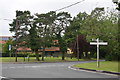
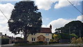
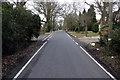
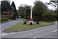
Living in CM8 3NG, a small residential postcode in Essex, means being part of a tight-knit community in Wickham Bishops, a village with roots in the Domesday Book. The area covers 4.9 hectares and is home to 2,086 people, with a population density of 206 per square kilometre. Its compact size fosters a sense of familiarity, where historic features like St Bartholomew’s Church and the elevated village position at 77 metres above sea level blend with modern living. Wickham Bishops lies three miles north of Maldon and two miles south-east of Witham, placing residents near two towns with distinct character. The village’s history as a medieval manor owned by the Bishop of London adds a layer of heritage, while its proximity to rail links and retail hubs like Morrisons and Tesco ensures practicality. Daily life here balances rural tranquillity with accessible amenities, making it appealing to those seeking a stable, low-maintenance lifestyle without sacrificing connectivity to nearby services.
- Area Type
- Postcode
- Area Size
- 4.9 hectares
- Population
- 2086
- Population Density
- 206 people/km²
The property market in CM8 3NG is dominated by owner-occupied homes, with 87% of properties in private hands. This high rate of home ownership suggests a community of settled residents rather than a rental market. The accommodation type is exclusively houses, which is unusual for modern developments but aligns with the village’s historic layout. The small area size of 4.9 hectares means the housing stock is limited, creating a scarcity of new builds and reinforcing the appeal of existing properties. Buyers should consider the proximity to nearby towns like Maldon and Witham for additional amenities, as the immediate area offers minimal new development. The predominance of houses also means properties are likely to be larger and more traditional, catering to families or retirees seeking space and stability.
House Prices in CM8 3NG
Showing 6 properties
| Address | Type | Beds | Baths | Last Sale Price | Last Sale Date | |
|---|---|---|---|---|---|---|
| 3 Birch Rise, Wickham Bishops, CM8 3NG | house | - | - | £587,500 | Feb 2024 | |
| 4 Birch Rise, Wickham Bishops, CM8 3NG | house | 4 | - | £405,000 | Apr 2014 | |
| 6 Birch Rise, Wickham Bishops, CM8 3NG | Bungalow | - | - | £348,995 | Oct 2013 | |
| 2 Birch Rise, Wickham Bishops, CM8 3NG | house | - | - | £406,000 | May 2013 | |
| 1 Birch Rise, Wickham Bishops, CM8 3NG | Detached | - | - | - | - | |
| 5 Birch Rise, Wickham Bishops, CM8 3NG | Detached | - | - | - | - |
Energy Efficiency in CM8 3NG
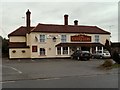
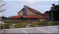
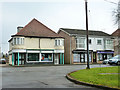
The lifestyle in CM8 3NG is shaped by its proximity to retail and rail hubs, as well as its historic character. Within practical reach are five retail outlets, including Morrisons Daily and Tesco Witham, offering everyday shopping needs. The village’s rail stations—Witham, Hatfield Peverel, and Kelvedon—provide regular services to Maldon and other towns, enhancing accessibility. Historic sites like St Bartholomew’s Church, with its electronic clock, and the restored St Peter’s Church, now a stained-glass studio, add cultural depth. The Library, a Victorian building, and Church Green, surrounded by period homes, contribute to a village feel. While parks are not explicitly listed, the elevated position of the village and nearby green spaces suggest opportunities for outdoor activities. The blend of practical amenities and heritage creates a balanced lifestyle, appealing to those who value both convenience and tradition.
Amenities
Schools
| Rank | School | Type | Entry gender | Ages |
|---|
Explore more schools in this area
Go to Schools tabDemographics
CM8 3NG has a median age of 47, with the majority of residents aged 30–64, reflecting a mature, established community. Home ownership is exceptionally high at 87%, indicating a strong presence of long-term residents and a stable housing market. The area is predominantly composed of houses, not flats, which aligns with the traditional character of the village. The predominant ethnic group is White, though specific data on other demographics is not provided. The population density of 206 people per square kilometre suggests a low-rise, spread-out settlement typical of rural Essex. This demographic profile implies a community focused on family living and retirement, with limited pressure from transient populations. The absence of detailed diversity statistics means the area’s social fabric is largely defined by its long-standing residents.
Household Size
Accommodation Type
Tenure
Ethnic Group
Religion
Household Composition
Age
Household Deprivation
NS-SEC
Explore more demographic insights in this area
Go to Demographics tabPlanning
Planning Constraints
- Flood RiskPremium
- Ramsar Wetland SitesPremium
- Area of Outstanding Natural BeautyPremium
- Protected Nature ReservePremium
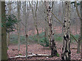
- Protected WoodlandPremium