Area Overview for CM8 3DR
Photos of CM8 3DR


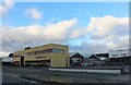


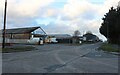
38 photos from this area
Area Information
Key information about the CM8 3DR including its size, population, and administrative classification.
- Area Type
- Postcode
- Area Size
- 9.5 hectares
- Population
- 1933
- Population Density
- 1688 people/km²
House Prices in CM8 3DR
10
Properties
-
Average Sold Price
-
Lowest Price
-
Highest Price
Showing 10 properties
| Address | Type | Beds | Baths | Last Sale Price | Last Sale Date | |
|---|---|---|---|---|---|---|
| Factory, 26 Crittall Road, Witham, CM8 3DR | Industrial | - | - | - | - | |
| Anglia Rustguard, 26 Crittall Road, Witham, CM8 3DR | Industrial | - | - | - | - | |
| Doe Motors Ltd, 2A Crittall Road, Witham, CM8 3DR | Industrial | - | - | - | - | |
| Dlala Studios Ltd, 22A Crittall Road, Witham, CM8 3DR | Office | - | - | - | - | |
| 25D Crittall Road, Witham, CM8 3DR | Office | - | - | - | - | |
| Unit 18, Crittall Road, Witham, CM8 3DR | warehouse | - | - | - | - | |
| Dlala Studios Ltd, 20 Crittall Road, Witham, CM8 3DR | commercial | - | - | - | - | |
| Target Shopfitters Ltd, 24 Crittall Road, Witham, CM8 3DR | Industrial | - | - | - | - | |
| Laurence Scott Property Ltd, 25C Crittall Road, Witham, CM8 3DR | Office | - | - | - | - | |
| Workshop At Abford Works, 12 Crittall Road, Witham, CM8 3DR | Industrial | - | - | - | - |
Energy Efficiency in CM8 3DR
Amenities
Schools
| Rank | School | Type | Entry gender | Ages |
|---|
Explore more schools in this area
Go to Schools tabDemographics
Household Size
One person
most common
Accommodation Type
Houses
most common
Tenure
62
majority
Ethnic Group
White
most common
Religion
N/A
most common
Household Composition
N/A
most common
Age
47
median
Adults (30-64 years)
most common
Household Deprivation
N/A
with no deprivation
NS-SEC
42
in Lower managerial occupations
Explore more demographic insights in this area
Go to Demographics tabPlanning
Planning Constraints
- Flood RiskPremium
- Ramsar Wetland SitesPremium
- Area of Outstanding Natural BeautyPremium
- Protected Nature ReservePremium
- Protected WoodlandPremium