Area Overview for CM77 8HR
Photos of CM77 8HR
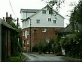
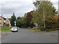
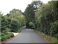
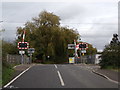
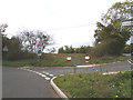
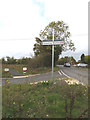
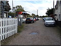
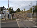
27 photos from this area
Area Information
Key information about the CM77 8HR including its size, population, and administrative classification.
- Area Type
- Postcode
- Area Size
- 4.1 hectares
- Population
- 2650
- Population Density
- 116 people/km²
House Prices in CM77 8HR
12
Properties
£355,500
Average Sold Price
£249,995
Lowest Price
£490,000
Highest Price
Showing 12 properties
| Address | Type | Beds | Baths | Last Sale Price | Last Sale Date | |
|---|---|---|---|---|---|---|
| 94 Mill Lane, Cressing, CM77 8HR | Detached | 3 | 2 | £490,000 | Aug 2024 | |
| 88 Mill Lane, Cressing, CM77 8HR | Detached | 3 | 1 | £385,000 | Sep 2021 | |
| 82 Mill Lane, Cressing, CM77 8HR | Detached | 4 | 1 | £425,000 | Jun 2020 | |
| 80 Mill Lane, Cressing, CM77 8HR | Detached | 3 | 2 | £365,000 | Jun 2020 | |
| 84 Mill Lane, Cressing, CM77 8HR | Detached | 4 | 2 | £385,000 | Jun 2018 | |
| 90 Mill Lane, Cressing, CM77 8HR | Semi-detached | 4 | 1 | £345,000 | Nov 2017 | |
| 74 Mill Lane, Cressing, CM77 8HR | Bungalow | - | - | £335,000 | Feb 2017 | |
| Colwood, Mill Lane, Cressing, CM77 8HR | Bungalow | - | - | £250,000 | Aug 2014 | |
| 76 Mill Lane, Cressing, CM77 8HR | Bungalow | - | - | £325,000 | Nov 2007 | |
| 86 Mill Lane, Cressing, CM77 8HR | house | - | - | £249,995 | Oct 2007 |
Page 1 of 2
Energy Efficiency in CM77 8HR
Amenities
Schools
| Rank | School | Type | Entry gender | Ages |
|---|
Explore more schools in this area
Go to Schools tabDemographics
Household Size
Two person
most common
Accommodation Type
Houses
most common
Tenure
73
majority
Ethnic Group
White
most common
Religion
N/A
most common
Household Composition
N/A
most common
Age
47
median
Adults (30-64 years)
most common
Household Deprivation
N/A
with no deprivation
NS-SEC
37
in Lower managerial occupations
Explore more demographic insights in this area
Go to Demographics tabPlanning
Planning Constraints
- Flood RiskPremium
- Ramsar Wetland SitesPremium
- Area of Outstanding Natural BeautyPremium
- Protected Nature ReservePremium
- Protected WoodlandPremium