Area Overview for CM77 6BT
Photos of CM77 6BT
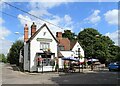
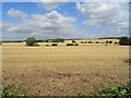
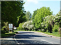
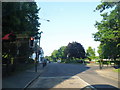
36 photos from this area
Area Information
Key information about the CM77 6BT including its size, population, and administrative classification.
- Area Type
- Postcode
- Area Size
- 6.3 hectares
- Population
- 2360
- Population Density
- 279 people/km²
House Prices in CM77 6BT
36
Properties
£338,792
Average Sold Price
£95,000
Lowest Price
£635,000
Highest Price
Showing 36 properties
| Address | Type | Beds | Baths | Last Sale Price | Last Sale Date | |
|---|---|---|---|---|---|---|
| 15 Shalford Road, Rayne, CM77 6BT | Detached | 3 | 1 | £635,000 | Feb 2025 | |
| 25 Shalford Road, Rayne, CM77 6BT | Bungalow | 3 | 2 | £525,000 | Jul 2024 | |
| 22 Shalford Road, Rayne, CM77 6BT | house | - | - | £333,000 | Sep 2021 | |
| 11 Shalford Road, Rayne, CM77 6BT | Detached | 3 | 2 | £600,000 | Feb 2021 | |
| 24 Shalford Road, Rayne, CM77 6BT | Semi-detached | 3 | 1 | £310,000 | Aug 2020 | |
| 36 Shalford Road, Rayne, CM77 6BT | house | - | - | £407,500 | May 2020 | |
| 38 Shalford Road, Rayne, CM77 6BT | house | - | - | £520,000 | Dec 2019 | |
| 2, Brookfields, Shalford Road, Rayne, CM77 6BT | house | - | - | £525,000 | Sep 2019 | |
| Marys Cottage, 13 Shalford Road, Rayne, CM77 6BT | Detached | 2 | - | £270,000 | Feb 2017 | |
| 8 Shalford Road, Rayne, CM77 6BT | house | - | - | £333,250 | Jul 2015 |
Page 1 of 4
Energy Efficiency in CM77 6BT
Amenities
Schools
| Rank | School | Type | Entry gender | Ages |
|---|
Explore more schools in this area
Go to Schools tabDemographics
Household Size
Two person
most common
Accommodation Type
Houses
most common
Tenure
82
majority
Ethnic Group
White
most common
Religion
N/A
most common
Household Composition
N/A
most common
Age
47
median
Adults (30-64 years)
most common
Household Deprivation
N/A
with no deprivation
NS-SEC
38
in Lower managerial occupations
Explore more demographic insights in this area
Go to Demographics tabPlanning
Planning Constraints
- Flood RiskPremium
- Ramsar Wetland SitesPremium
- Area of Outstanding Natural BeautyPremium
- Protected Nature ReservePremium
- Protected WoodlandPremium