Area Overview for CM7 9UU
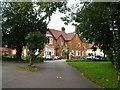
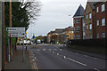
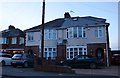
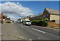
Photos of CM7 9UU
Area Information
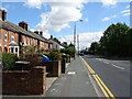
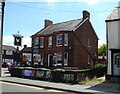
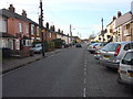
Living in CM7 9UU means being part of a small, tightly knit residential cluster in the heart of Braintree District, Essex. With a population of 1,815, this area blends historical charm with modern convenience. Situated along the Blackwater River, it is part of the Bocking Blackwater Ward, a historic village linked to Braintree through centuries of trade and industry. The area’s character is shaped by its proximity to Braintree, offering access to urban amenities while retaining a village feel. Daily life here is defined by a quiet, suburban rhythm, with residents benefiting from nearby retail, transport, and cultural landmarks. The presence of Grade I listed buildings like St Mary’s Deanery Church and Bocking Windmill adds a unique historical dimension, while the surrounding landscape reflects the area’s industrial past, including former silk mills. This postcode is ideal for those seeking a balance between tranquillity and connectivity, with easy access to Braintree’s services and a community rooted in tradition.
- Area Type
- Postcode
- Area Size
- Not available
- Population
- 1815
- Population Density
- 3621 people/km²
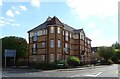
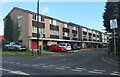
The property market in CM7 9UU is dominated by owner-occupied homes, with 79% of residents living in their own houses. This high home ownership rate indicates a stable, long-term community with limited rental activity. The prevalence of houses over flats suggests a focus on family-friendly housing, which is typical of suburban areas. Given the small size of the postcode, the housing stock is likely limited, meaning buyers may need to consider nearby areas for more options. The absence of large-scale developments or commercial properties reinforces the area’s residential character. For those seeking a home, the market offers a mix of traditional properties, potentially with historical features, though competition for available listings may be fierce due to the area’s desirability. Buyers should also consider proximity to Braintree, where additional property choices may be found.
House Prices in CM7 9UU
No properties found in this postcode.
Energy Efficiency in CM7 9UU
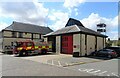
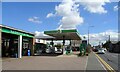
Life in CM7 9UU is enriched by a mix of practical amenities and historical attractions. Residents have access to five retail outlets, including major supermarkets like Tesco Braintree and Sainsburys Braintree, ensuring everyday needs are met locally. The area’s transport links, including a bus interchange and multiple railway stations, provide easy access to Braintree and beyond. For leisure, the nearby Blackwater River and historic sites such as St Mary’s Deanery Church, Bocking Hall, and the Grade I listed Bocking Windmill offer cultural and recreational opportunities. These landmarks, combined with the area’s industrial heritage, create a unique blend of natural beauty and historical significance. The presence of these amenities fosters a sense of community, with residents able to enjoy both modern convenience and the charm of a historic village setting.
Amenities
Schools
| Rank | School | Type | Entry gender | Ages |
|---|
Explore more schools in this area
Go to Schools tabDemographics
The community in CM7 9UU is predominantly composed of adults aged 30–64, with a median age of 47. This suggests a population skewed towards middle-aged individuals, likely including families and professionals. Home ownership is high at 79%, indicating a stable, long-term resident base. The area is characterised by houses rather than flats, reflecting a preference for private, family-oriented living. The predominant ethnic group is White, which aligns with broader trends in the region. The absence of specific data on deprivation means the quality of life can be inferred from the low crime score (72/100) and minimal environmental risks. This demographic profile points to a community that values stability, with residents likely prioritising property ownership and proximity to local amenities. The age range also suggests a mix of established families and retirees, contributing to a mature, low-turnover neighbourhood.
Household Size
Accommodation Type
Tenure
Ethnic Group
Religion
Household Composition
Age
Household Deprivation
NS-SEC
Explore more demographic insights in this area
Go to Demographics tabPlanning
Planning Constraints
- Flood RiskPremium
- Ramsar Wetland SitesPremium
- Area of Outstanding Natural BeautyPremium
- Protected Nature ReservePremium
- Protected WoodlandPremium