Area Overview for CM7 9TN
Photos of CM7 9TN
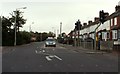
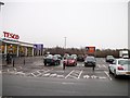
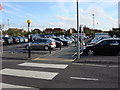

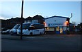
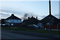
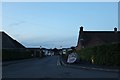
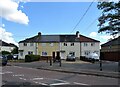
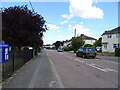
22 photos from this area
Area Information
Key information about the CM7 9TN including its size, population, and administrative classification.
- Area Type
- Postcode
- Area Size
- 1.6 hectares
- Population
- 1614
- Population Density
- 2421 people/km²
House Prices in CM7 9TN
49
Properties
£205,084
Average Sold Price
£1,500
Lowest Price
£400,000
Highest Price
Showing 49 properties
| Address | Type | Beds | Baths | Last Sale Price | Last Sale Date | |
|---|---|---|---|---|---|---|
| 31 Anson Way, Braintree, CM7 9TN | Detached | 4 | 3 | £400,000 | Sep 2025 | |
| 6 Anson Way, Braintree, CM7 9TN | house | - | - | £398,000 | Jun 2025 | |
| 36 Anson Way, Braintree, CM7 9TN | Semi-detached | 3 | 1 | £270,000 | Jan 2025 | |
| 58 Anson Way, Braintree, CM7 9TN | house | - | - | £320,000 | Aug 2023 | |
| 42 Anson Way, Braintree, CM7 9TN | Semi-detached | 3 | 1 | £298,000 | Mar 2022 | |
| 60 Anson Way, Braintree, CM7 9TN | Semi-detached | 3 | 1 | £320,000 | Jan 2022 | |
| 46 Anson Way, Braintree, CM7 9TN | house | - | - | £275,000 | Aug 2021 | |
| 26 Anson Way, Braintree, CM7 9TN | house | - | - | £265,000 | May 2021 | |
| 20 Anson Way, Braintree, CM7 9TN | Terraced | - | - | £263,000 | Mar 2021 | |
| 17 Anson Way, Braintree, CM7 9TN | house | - | - | £275,000 | Nov 2020 |
Page 1 of 5
Energy Efficiency in CM7 9TN
Amenities
Schools
| Rank | School | Type | Entry gender | Ages |
|---|
Explore more schools in this area
Go to Schools tabDemographics
Household Size
Family (3-5 people)
most common
Accommodation Type
Houses
most common
Tenure
89
majority
Ethnic Group
White
most common
Religion
N/A
most common
Household Composition
N/A
most common
Age
47
median
Adults (30-64 years)
most common
Household Deprivation
N/A
with no deprivation
NS-SEC
40
in Lower managerial occupations
Explore more demographic insights in this area
Go to Demographics tabPlanning
Planning Constraints
- Flood RiskPremium
- Ramsar Wetland SitesPremium
- Area of Outstanding Natural BeautyPremium
- Protected Nature ReservePremium
- Protected WoodlandPremium