Area Overview for CM7 9SE
Photos of CM7 9SE
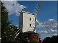
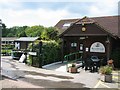
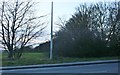

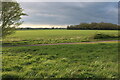
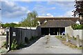
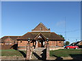
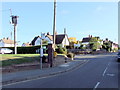
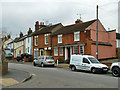
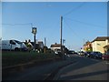
18 photos from this area
Area Information
Key information about the CM7 9SE including its size, population, and administrative classification.
- Area Type
- Postcode
- Area Size
- 13.5 hectares
- Population
- 1493
- Population Density
- 437 people/km²
House Prices in CM7 9SE
41
Properties
£450,233
Average Sold Price
£125,000
Lowest Price
£1,250,000
Highest Price
Showing 41 properties
| Address | Type | Beds | Baths | Last Sale Price | Last Sale Date | |
|---|---|---|---|---|---|---|
| 75 Thistley Green Road, Braintree, CM7 9SE | Terraced | 3 | 1 | £265,000 | Feb 2025 | |
| 74 Thistley Green Road, Braintree, CM7 9SE | Terraced | 3 | 1 | £325,000 | Jul 2024 | |
| Moongate, Thistley Green Road, Braintree, CM7 9SE | Detached | 6 | 4 | £1,250,000 | Oct 2022 | |
| 12 Thistley Green Road, Braintree, CM7 9SE | Retail | 3 | 1 | £400,000 | Dec 2021 | |
| 24 Thistley Green Road, Braintree, CM7 9SE | house | - | - | £795,000 | Apr 2021 | |
| 17 Thistley Green Road, Braintree, CM7 9SE | Bungalow | 4 | 2 | £467,500 | Jul 2018 | |
| 9 Thistley Green Road, Braintree, CM7 9SE | Detached | 3 | - | £520,000 | Dec 2014 | |
| 19 Thistley Green Road, Braintree, CM7 9SE | Detached | - | - | £136,000 | Nov 2013 | |
| 20 Thistley Green Road, Braintree, CM7 9SE | Land | - | - | £500,000 | May 2013 | |
| 22 Thistley Green Road, Braintree, CM7 9SE | house | - | - | £515,000 | May 2013 |
Page 1 of 5
Energy Efficiency in CM7 9SE
Amenities
Schools
| Rank | School | Type | Entry gender | Ages |
|---|
Explore more schools in this area
Go to Schools tabDemographics
Household Size
Two person
most common
Accommodation Type
Houses
most common
Tenure
76
majority
Ethnic Group
White
most common
Religion
N/A
most common
Household Composition
N/A
most common
Age
47
median
Adults (30-64 years)
most common
Household Deprivation
N/A
with no deprivation
NS-SEC
33
in Lower managerial occupations
Explore more demographic insights in this area
Go to Demographics tabPlanning
Planning Constraints
- Flood RiskPremium
- Ramsar Wetland SitesPremium
- Area of Outstanding Natural BeautyPremium
- Protected Nature ReservePremium
- Protected WoodlandPremium