Area Overview for CM7 6SP
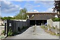
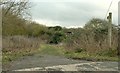
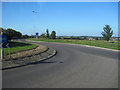
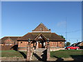
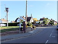
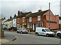
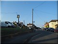
Photos of CM7 6SP

Area Information
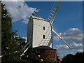
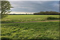
Living in CM7 6SP means inhabiting a small, residential cluster in the northern suburbs of Bocking, near Braintree in Essex. With a population of 1,493 and a density of 437 people per square kilometre, this area blends suburban convenience with rural character. It lies within Bocking North Ward, a historic parish once linked to Canterbury’s monastic holdings and the Courtauld silk industry. Today, it feels like a quiet extension of Braintree, with open fields and nature trails bordering the built-up area. The proximity to Braintree offers access to urban amenities, while the surrounding countryside provides a slower pace of life. Residents often use CM7 6SP as a cut-through to Halstead and Suffolk, blending suburban comfort with easy connectivity. The area’s history is etched into its architecture, from the 1500s Bocking Hall to the restored 1721 windmill. For those seeking a peaceful yet practical location, CM7 6SP offers a balance of heritage and modernity, with homes nestled near both historic sites and contemporary infrastructure.
- Area Type
- Postcode
- Area Size
- Not available
- Population
- 1493
- Population Density
- 437 people/km²
The property market in CM7 6SP is characterised by a high rate of home ownership (76%) and a focus on houses rather than flats or apartments. This suggests a suburban, family-oriented area where properties are likely to be larger and more private than in denser urban zones. The small size of the postcode area means the housing stock is limited, with few new developments. Buyers should consider the proximity to Braintree, where more property options exist, but CM7 6SP itself offers a quieter, low-density alternative. The high home ownership rate indicates strong community stability, with properties potentially holding value over time. However, the limited number of homes means competition could be fierce for available listings. For those prioritising space and a slower pace, CM7 6SP’s houses offer a compelling proposition, though buyers must weigh the area’s small size against its rural charm and convenient links to nearby towns.
House Prices in CM7 6SP
No properties found in this postcode.
Energy Efficiency in CM7 6SP
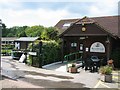
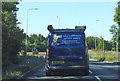
The lifestyle in CM7 6SP is defined by its proximity to both rural tranquillity and suburban convenience. Within practical reach are five retail venues, including Tesco Braintree and the Chelmsford Star Co-operative Society, offering everyday shopping needs. The area’s transport links, via bus and rail, connect residents to Braintree’s shopping centres and leisure facilities. Nearby nature trails and open fields provide opportunities for walking and outdoor activities, reinforcing the area’s rural character. The presence of multiple rail stations, including Braintree Freeport, ensures access to urban amenities without the need for a car. While the postcode itself lacks major leisure venues, its position as a suburban extension of Braintree means residents can enjoy the best of both worlds: a peaceful, low-density environment with easy access to city life.
Amenities
Schools
The only school explicitly listed near CM7 6SP is Advanced Education-Pear Trees, a special school. This indicates that the area does not host mainstream primary or secondary schools, requiring families to seek education options in nearby Braintree or Halstead. The presence of a special school suggests the area may cater to specific educational needs, but parents of children with typical learning requirements would need to look further afield. Without data on other schools, it is unclear whether the local education landscape is well-served for all age groups. Families considering CM7 6SP should investigate nearby school catchment areas and transport links to ensure their children’s educational needs are met, particularly if they require mainstream schooling.
| Rank | School | Type | Entry gender | Ages |
|---|
Explore more schools in this area
Go to Schools tabDemographics
The community in CM7 6SP is predominantly composed of adults aged 30–64, with a median age of 47. This suggests a mature, stable population, likely with established careers and families. Home ownership is high, at 76%, indicating a community of long-term residents rather than transient renters. The accommodation type is primarily houses, reflecting a suburban layout with more private, spacious properties than flats. The predominant ethnic group is White, which aligns with broader trends in the region. While no specific deprivation data is provided, the high home ownership rate and low crime score (87/100) suggest a relatively affluent, low-risk environment. The age profile implies a population focused on family life, with fewer young children or elderly residents compared to other areas. This demographic likely influences local services and amenities, which cater to adult needs rather than those of children or retirees.
Household Size
Accommodation Type
Tenure
Ethnic Group
Religion
Household Composition
Age
Household Deprivation
NS-SEC
Explore more demographic insights in this area
Go to Demographics tabPlanning
Planning Constraints
- Flood RiskPremium
- Ramsar Wetland SitesPremium
- Area of Outstanding Natural BeautyPremium
- Protected Nature ReservePremium
- Protected WoodlandPremium