Area Overview for CM7 5HQ
Photos of CM7 5HQ
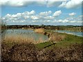
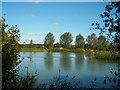
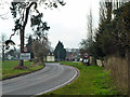
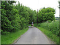
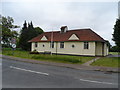
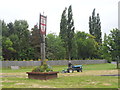
8 photos from this area
Area Information
Key information about the CM7 5HQ including its size, population, and administrative classification.
- Area Type
- Postcode
- Area Size
- 39.7 hectares
- Population
- 2167
- Population Density
- 79 people/km²
House Prices in CM7 5HQ
25
Properties
£213,333
Average Sold Price
£60,000
Lowest Price
£360,000
Highest Price
Showing 25 properties
| Address | Type | Beds | Baths | Last Sale Price | Last Sale Date | |
|---|---|---|---|---|---|---|
| 7 Braintree Road, Shalford, CM7 5HQ | house | 3 | 1 | £205,000 | May 2018 | |
| 8 Braintree Road, Shalford, CM7 5HQ | Terraced | 3 | 1 | £205,000 | Sep 2014 | |
| 12 Braintree Road, Shalford, CM7 5HQ | house | - | - | £170,000 | Jul 2014 | |
| Ivydene, Braintree Road, Shalford, CM7 5HQ | Bungalow | 3 | - | £280,000 | Dec 2013 | |
| Kelele Cottage, Braintree Road, Shalford, CM7 5HQ | house | 4 | - | £360,000 | Sep 2011 | |
| 2, Hill Farm Cottages, Braintree Road, Shalford, CM7 5HQ | house | - | - | £60,000 | Apr 1998 | |
| 1 Braintree Road, Shalford, CM7 5HQ | Flat | 2 | 1 | - | - | |
| 6 Braintree Road, Shalford, CM7 5HQ | Terraced | 3 | 1 | - | - | |
| Former Civic Amenity And Recycling Centre, Braintree Road, Shalford, CM7 5HQ | commercial | - | - | - | - | |
| Park House, Braintree Road, Shalford, CM7 5HQ | Detached | - | - | - | - |
Page 1 of 3
Energy Efficiency in CM7 5HQ
Amenities
Schools
| Rank | School | Type | Entry gender | Ages |
|---|
Explore more schools in this area
Go to Schools tabDemographics
Household Size
Two person
most common
Accommodation Type
Houses
most common
Tenure
76
majority
Ethnic Group
White
most common
Religion
N/A
most common
Household Composition
N/A
most common
Age
47
median
Adults (30-64 years)
most common
Household Deprivation
N/A
with no deprivation
NS-SEC
37
in Lower managerial occupations
Explore more demographic insights in this area
Go to Demographics tabPlanning
Planning Constraints
- Flood RiskPremium
- Ramsar Wetland SitesPremium
- Area of Outstanding Natural BeautyPremium
- Protected Nature ReservePremium
- Protected WoodlandPremium