Area Overview for CM7 4PH
Photos of CM7 4PH
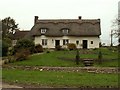
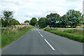

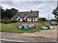
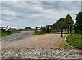
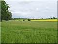
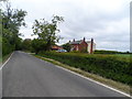
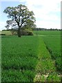
8 photos from this area
Area Information
Key information about the CM7 4PH including its size, population, and administrative classification.
- Area Type
- Postcode
- Area Size
- 1.2 km²
- Population
- 1443
- Population Density
- 43 people/km²
House Prices in CM7 4PH
10
Properties
£556,250
Average Sold Price
£315,000
Lowest Price
£690,000
Highest Price
Showing 10 properties
| Address | Type | Beds | Baths | Last Sale Price | Last Sale Date | |
|---|---|---|---|---|---|---|
| Holly Cottage, Upper Howe Street, Finchingfield, CM7 4PH | house | - | - | £690,000 | Feb 2021 | |
| Whittons Farm, Upper Howe Street, Finchingfield, CM7 4PH | Detached | 6 | - | £663,750 | Jun 2006 | |
| Yeldhams Cottage, Upper Howe Street, Finchingfield, CM7 4PH | Detached | - | - | £315,000 | Feb 2000 | |
| Dove House, Upper Howe Street, Finchingfield, CM7 4PH | Detached | 5 | 5 | - | - | |
| Annexe At Whittons Farm West Wing, Upper Howe Street, Finchingfield, CM7 4PH | Detached | - | - | - | - | |
| Obournes Farm, Upper Howe Street, Finchingfield, CM7 4PH | Farm | - | - | - | - | |
| The Barretts, Upper Howe Street, Finchingfield, CM7 4PH | Detached | - | - | - | - | |
| Buckeye House, Upper Howe Street, Finchingfield, CM7 4PH | Detached | - | - | - | - | |
| Annexe At The Cart Lodge, Whittons Farm, Upper Howe Street, Finchingfield, CM7 4PH | Office | - | - | - | - | |
| Annexe At, Dove House, Upper Howe Street, Finchingfield, CM7 4PH | Detached | - | - | - | - |
Energy Efficiency in CM7 4PH
Amenities
Schools
| Rank | School | Type | Entry gender | Ages |
|---|
Explore more schools in this area
Go to Schools tabDemographics
Household Size
Family (3-5 people)
most common
Accommodation Type
Houses
most common
Tenure
69
majority
Ethnic Group
White
most common
Religion
N/A
most common
Household Composition
N/A
most common
Age
47
median
Adults (30-64 years)
most common
Household Deprivation
N/A
with no deprivation
NS-SEC
42
in Lower managerial occupations
Explore more demographic insights in this area
Go to Demographics tabPlanning
Planning Constraints
- Flood RiskPremium
- Ramsar Wetland SitesPremium
- Area of Outstanding Natural BeautyPremium
- Protected Nature ReservePremium
- Protected WoodlandPremium