Area Overview for CM7 4DU
Photos of CM7 4DU
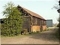
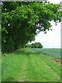
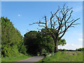
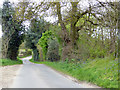
4 photos from this area
Area Information
Key information about the CM7 4DU including its size, population, and administrative classification.
- Area Type
- Postcode
- Area Size
- 88.9 hectares
- Population
- 1295
- Population Density
- 76 people/km²
House Prices in CM7 4DU
17
Properties
£595,666
Average Sold Price
£17,000
Lowest Price
£1,175,000
Highest Price
Showing 17 properties
| Address | Type | Beds | Baths | Last Sale Price | Last Sale Date | |
|---|---|---|---|---|---|---|
| Kemballs, Lower Green Road, Blackmore End, Wethersfield, CM7 4DU | Detached | 3 | 1 | £610,000 | May 2024 | |
| Thanet House, Lower Green Road, Blackmore End, Wethersfield, CM7 4DU | Retail | 4 | 3 | £860,000 | Sep 2022 | |
| Lower Common House, Lower Green Road, Blackmore End, Wethersfield, CM7 4DU | house | - | - | £440,000 | Dec 2021 | |
| Lealands Farmhouse, Lower Green Road, Blackmore End, Wethersfield, CM7 4DU | Bungalow | 3 | 2 | £1,175,000 | Jan 2021 | |
| Barbery Green, Lower Green Road, Blackmore End, Wethersfield, CM7 4DU | Detached | 5 | 2 | £696,000 | Oct 2018 | |
| Maples View, Lower Green Road, Blackmore End, Wethersfield, CM7 4DU | Bungalow | 3 | 2 | £385,000 | May 2018 | |
| Chartwell, Lower Green Road, Blackmore End, Wethersfield, CM7 4DU | Bungalow | - | - | £425,000 | May 2018 | |
| Lower Green Farm, Lower Green Road, Blackmore End, Wethersfield, CM7 4DU | Detached | 5 | 2 | £770,000 | Sep 2017 | |
| Rosemary Cottage, Lower Green Road, Blackmore End, Wethersfield, CM7 4DU | Detached | 4 | 3 | £720,000 | Apr 2017 | |
| The Cottage, Lower Green Road, Blackmore End, Wethersfield, CM7 4DU | Detached | 5 | 2 | £17,000 | Oct 2016 |
Page 1 of 2
Energy Efficiency in CM7 4DU
Amenities
Schools
| Rank | School | Type | Entry gender | Ages |
|---|
Explore more schools in this area
Go to Schools tabDemographics
Household Size
Two person
most common
Accommodation Type
Houses
most common
Tenure
83
majority
Ethnic Group
White
most common
Religion
N/A
most common
Household Composition
N/A
most common
Age
47
median
Adults (30-64 years)
most common
Household Deprivation
N/A
with no deprivation
NS-SEC
37
in Lower managerial occupations
Explore more demographic insights in this area
Go to Demographics tabPlanning
Planning Constraints
- Flood RiskPremium
- Ramsar Wetland SitesPremium
- Area of Outstanding Natural BeautyPremium
- Protected Nature ReservePremium