Area Overview for CM7 2DA
Photos of CM7 2DA


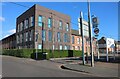
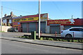

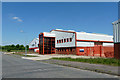
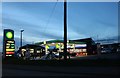
13 photos from this area
Area Information
Key information about the CM7 2DA including its size, population, and administrative classification.
- Area Type
- Postcode
- Area Size
- 3.5 hectares
- Population
- 2543
- Population Density
- 1663 people/km²
House Prices in CM7 2DA
58
Properties
£466,325
Average Sold Price
£359,995
Lowest Price
£569,995
Highest Price
Showing 58 properties
| Address | Type | Beds | Baths | Last Sale Price | Last Sale Date | |
|---|---|---|---|---|---|---|
| 35 Broomfield Way, Braintree, CM7 2DA | Detached | 4 | 2 | £525,000 | Dec 2025 | |
| 64 Broomfield Way, Braintree, CM7 2DA | Detached | 4 | 3 | £535,000 | Jun 2025 | |
| 11 Broomfield Way, Braintree, CM7 2DA | Semi-detached | 4 | 3 | £469,000 | Mar 2024 | |
| 66 Broomfield Way, Braintree, CM7 2DA | house | 4 | 3 | £430,000 | Feb 2024 | |
| 23 Broomfield Way, Braintree, CM7 2DA | house | - | - | £492,500 | Feb 2023 | |
| 2 Broomfield Way, Braintree, CM7 2DA | house | - | - | £539,995 | Mar 2022 | |
| 43 Broomfield Way, Braintree, CM7 2DA | house | - | - | £534,995 | Dec 2020 | |
| 45 Broomfield Way, Braintree, CM7 2DA | house | 4 | 2 | £499,995 | Nov 2020 | |
| 51 Broomfield Way, Braintree, CM7 2DA | house | - | - | £359,995 | Sep 2020 | |
| 49 Broomfield Way, Braintree, CM7 2DA | house | - | - | £359,995 | Sep 2020 |
Page 1 of 6
Energy Efficiency in CM7 2DA
Amenities
Schools
| Rank | School | Type | Entry gender | Ages |
|---|
Explore more schools in this area
Go to Schools tabDemographics
Household Size
Family (3-5 people)
most common
Accommodation Type
Houses
most common
Tenure
48
majority
Ethnic Group
White
most common
Religion
N/A
most common
Household Composition
N/A
most common
Age
47
median
Adults (30-64 years)
most common
Household Deprivation
N/A
with no deprivation
NS-SEC
26
in Lower managerial occupations
Explore more demographic insights in this area
Go to Demographics tabPlanning
Planning Constraints
- Flood RiskPremium
- Ramsar Wetland SitesPremium
- Area of Outstanding Natural BeautyPremium
- Protected Nature ReservePremium
- Protected WoodlandPremium