Area Overview for CM6 2LH
Photos of CM6 2LH
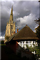
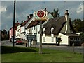
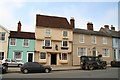

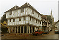
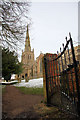
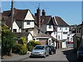
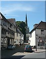
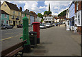
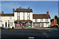
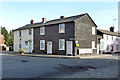
88 photos from this area
Area Information
Key information about the CM6 2LH including its size, population, and administrative classification.
- Area Type
- Postcode
- Area Size
- 2060 m²
- Population
- 2255
- Population Density
- 621 people/km²
House Prices in CM6 2LH
6
Properties
£393,690
Average Sold Price
£367,000
Lowest Price
£446,500
Highest Price
Showing 6 properties
| Address | Type | Beds | Baths | Last Sale Price | Last Sale Date | |
|---|---|---|---|---|---|---|
| Amber House, Orange Street, Thaxted, CM6 2LH | Terraced | 3 | 2 | £367,000 | Dec 2018 | |
| Marigolds, Orange Street, Thaxted, CM6 2LH | Terraced | 3 | 2 | £385,000 | Nov 2016 | |
| Clementine Cottage, Orange Street, Thaxted, CM6 2LH | Terraced | 3 | 2 | £399,950 | Oct 2016 | |
| Cutlers Cottage, Orange Street, Thaxted, CM6 2LH | Detached | 4 | - | £370,000 | Jul 2015 | |
| Elmswood, Orange Street, Thaxted, CM6 2LH | house | 6 | 3 | £446,500 | Aug 2007 | |
| Easters, Orange Street, Thaxted, CM6 2LH | Detached | 2 | - | - | - |
Energy Efficiency in CM6 2LH
Amenities
Schools
| Rank | School | Type | Entry gender | Ages |
|---|
Explore more schools in this area
Go to Schools tabDemographics
Household Size
Family (3-5 people)
most common
Accommodation Type
Houses
most common
Tenure
67
majority
Ethnic Group
White
most common
Religion
N/A
most common
Household Composition
N/A
most common
Age
47
median
Adults (30-64 years)
most common
Household Deprivation
N/A
with no deprivation
NS-SEC
36
in Lower managerial occupations
Explore more demographic insights in this area
Go to Demographics tabPlanning
Planning Constraints
- Flood RiskPremium
- Ramsar Wetland SitesPremium
- Area of Outstanding Natural BeautyPremium
- Protected Nature ReservePremium
- Protected WoodlandPremium