Area Overview for CM6 1ND
Photos of CM6 1ND
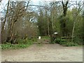
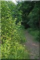
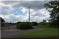
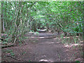
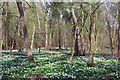

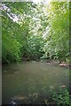
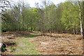
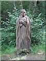
9 photos from this area
Area Information
Key information about the CM6 1ND including its size, population, and administrative classification.
- Area Type
- Postcode
- Area Size
- 1.5 km²
- Population
- 1646
- Population Density
- 59 people/km²
House Prices in CM6 1ND
26
Properties
£535,625
Average Sold Price
£350,000
Lowest Price
£900,000
Highest Price
Showing 26 properties
| Address | Type | Beds | Baths | Last Sale Price | Last Sale Date | |
|---|---|---|---|---|---|---|
| Tye Green Farmhouse, High Easter Road, Barnston, CM6 1ND | Detached | 7 | 3 | £900,000 | May 2024 | |
| The Cart Lodge, High Easter Road, Barnston, CM6 1ND | Semi-detached | 3 | 3 | £525,000 | Jan 2023 | |
| Parkers Croft, High Easter Road, Barnston, CM6 1ND | house | 4 | 2 | £350,000 | Oct 2005 | |
| Sallets Barn, High Easter Road, Barnston, CM6 1ND | Land | - | - | £367,500 | Nov 2001 | |
| Albans, High Easter Road, Barnston, CM6 1ND | Detached | 6 | 3 | - | - | |
| Sallets Farmhouse, High Easter Road, Barnston, CM6 1ND | Semi-detached | - | - | - | - | |
| Mobile Home At The Oaks, High Easter Road, Barnston, CM6 1ND | Semi-detached | 3 | 2 | - | - | |
| Oaktree Barns, High Easter Road, Barnston, CM6 1ND | Detached | 2 | 2 | - | - | |
| Mawkinherds Farm, High Easter Road, Barnston, CM6 1ND | house | 3 | - | - | - | |
| Existing Barn, Mawkinherds Farm, High Easter Road, Barnston, CM6 1ND | Detached | - | - | - | - |
Page 1 of 3
Energy Efficiency in CM6 1ND
Amenities
Schools
| Rank | School | Type | Entry gender | Ages |
|---|
Explore more schools in this area
Go to Schools tabDemographics
Household Size
Two person
most common
Accommodation Type
Houses
most common
Tenure
76
majority
Ethnic Group
White
most common
Religion
N/A
most common
Household Composition
N/A
most common
Age
47
median
Adults (30-64 years)
most common
Household Deprivation
N/A
with no deprivation
NS-SEC
40
in Lower managerial occupations
Explore more demographic insights in this area
Go to Demographics tabPlanning
Planning Constraints
- Flood RiskPremium
- Ramsar Wetland SitesPremium
- Area of Outstanding Natural BeautyPremium
- Protected Nature ReservePremium
- Protected WoodlandPremium