Area Overview for CM5 9SA
Photos of CM5 9SA


Area Information
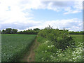
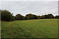
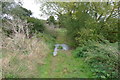
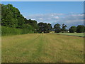
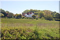
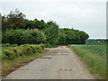
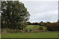
CM5 9SA is a small, rural postcode area nestled in the Epping Forest district of Essex, encompassing parts of the historic parish of High Ongar. With a population of 2,464 spread across a low-density settlement of 54 people per square kilometre, this area retains a quiet, village-like character. Its proximity to Chipping Ongar, a market town carved from the surrounding rural landscape, offers residents a balance of seclusion and access to local services. The area’s historical roots are evident in landmarks like St Mary’s Church, a 12th-century structure with medieval architecture and a 13th-century bell tower. Daily life here is shaped by its rural setting, with a focus on community and tradition. The low population density suggests a slower pace, ideal for those seeking a peaceful environment away from urban centres. While the area is small, its connection to nearby towns and transport links ensures it is not isolated. For buyers, CM5 9SA represents a chance to own a home in a historically rich, low-density environment with a distinct sense of place.
- Area Type
- Postcode
- Area Size
- Not available
- Population
- 2464
- Population Density
- 54 people/km²
The property market in CM5 9SA is dominated by owner-occupied homes, with 74% of properties owned by residents rather than rented. This suggests a stable market where long-term residency is common. The accommodation type is primarily houses, which aligns with the area’s rural character and the preference for larger, private properties. In a small postcode area like CM5 9SA, the housing stock is likely limited, making it a niche market for buyers seeking a specific type of property. The predominance of houses may appeal to families or individuals looking for space and privacy. However, the limited size of the area means that property availability is constrained, and buyers may need to consider nearby suburbs or towns for additional options. The high home ownership rate also indicates that the area is less influenced by rental demand, focusing instead on local residents who value stability and long-term investment.
House Prices in CM5 9SA
No properties found in this postcode.
Energy Efficiency in CM5 9SA
Life in CM5 9SA revolves around a mix of local amenities and nearby services. Within practical reach are five retail outlets, including Tesco Ongar, Sainsburys Chipping, and the Chelmsford Star Co-operative Society, providing access to groceries, household goods, and other essentials. The area’s rural character is complemented by proximity to Ingatestone Railway Station, offering connections to urban centres. For leisure, the Nine Ashes pub, now known as Kings Brasserie, offers a social hub for residents. Historical sites like St Mary’s Church add cultural value, while the nearby North Weald Airport caters to those requiring regional travel. The combination of small-town charm and accessible services creates a lifestyle that balances convenience with a peaceful, low-density environment.
Amenities
Schools
The primary school closest to CM5 9SA is High Ongar Primary School, which serves the local community with a good Ofsted rating. As a primary school, it caters to children aged 4–11, providing foundational education for young families in the area. The presence of a single primary school suggests that secondary education options may be located in nearby towns such as Chipping Ongar or Epping. For families prioritising strong primary education, the good rating at High Ongar Primary School is a significant advantage. However, the lack of secondary schools in the immediate area means that parents may need to plan for commuting to larger towns. The school’s rating reflects a satisfactory standard of teaching and facilities, though it does not provide information on specialist subjects or extracurricular offerings.
| Rank | School | Type | Entry gender | Ages |
|---|
Explore more schools in this area
Go to Schools tabDemographics
The community in CM5 9SA is predominantly composed of adults aged 30–64, with a median age of 47. This suggests a mature population, likely with established careers and families. Home ownership is high, at 74%, indicating a stable, long-term resident base. The area is characterised by houses rather than flats, reflecting a preference for larger, private living spaces. The predominant ethnic group is White, with no specific data provided on other demographics. The age profile and home ownership rates imply a community focused on family life and long-term residency. The absence of detailed diversity data means the area’s cultural makeup remains less defined, but the demographic trends point to a cohesive, settled population. The low population density further supports the idea of a close-knit community where social ties are likely to be strong.
Household Size
Accommodation Type
Tenure
Ethnic Group
Religion
Household Composition
Age
Household Deprivation
NS-SEC
Explore more demographic insights in this area
Go to Demographics tabPlanning
Planning Constraints
- Flood RiskPremium
- Ramsar Wetland SitesPremium
- Area of Outstanding Natural BeautyPremium
- Protected Nature ReservePremium
- Protected WoodlandPremium