Area Overview for CM5 9PZ
Photos of CM5 9PZ
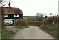
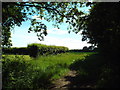
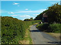
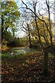

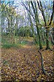
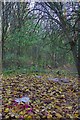

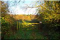
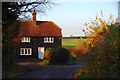
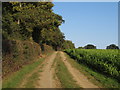
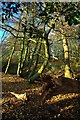
16 photos from this area
Area Information
Key information about the CM5 9PZ including its size, population, and administrative classification.
- Area Type
- Postcode
- Area Size
- 1.0 km²
- Population
- 2519
- Population Density
- 52 people/km²
House Prices in CM5 9PZ
9
Properties
£1,135,000
Average Sold Price
£830,000
Lowest Price
£1,300,000
Highest Price
Showing 9 properties
| Address | Type | Beds | Baths | Last Sale Price | Last Sale Date | |
|---|---|---|---|---|---|---|
| Blossom House, Berwick Lane, Stanford Rivers, Ongar, CM5 9PZ | house | - | - | £1,300,000 | Oct 2019 | |
| Forest Grange, 39 Berwick Lane, Stanford Rivers, Ongar, CM5 9PZ | Detached | 4 | 2 | £1,275,000 | Dec 2018 | |
| Meadow Rise, 38 Berwick Lane, Stanford Rivers, Ongar, CM5 9PZ | Detached | 4 | 2 | £830,000 | Aug 2018 | |
| Magnolia Cottage, 36 Berwick Lane, Stanford Rivers, Ongar, CM5 9PZ | Detached | 6 | 3 | - | - | |
| Barn, Meadow Rise Now Cedar Lodge No 37, 38 Berwick Lane, Stanford Rivers, Ongar, CM5 9PZ | Semi-detached | - | - | - | - | |
| 34 Berwick Lane, Stanford Rivers, Ongar, CM5 9PZ | house | - | - | - | - | |
| 33 Berwick Lane, Stanford Rivers, Ongar, CM5 9PZ | house | - | - | - | - | |
| Cedar Lodge, 37 Berwick Lane, Stanford Rivers, Ongar, CM5 9PZ | Bungalow | - | - | - | - | |
| 39A Berwick Lane, Stanford Rivers, Ongar, CM5 9PZ | house | - | - | - | - |
Energy Efficiency in CM5 9PZ
Amenities
Schools
| Rank | School | Type | Entry gender | Ages |
|---|
Explore more schools in this area
Go to Schools tabDemographics
Household Size
Family (3-5 people)
most common
Accommodation Type
Houses
most common
Tenure
77
majority
Ethnic Group
White
most common
Religion
N/A
most common
Household Composition
N/A
most common
Age
47
median
Adults (30-64 years)
most common
Household Deprivation
N/A
with no deprivation
NS-SEC
35
in Lower managerial occupations
Explore more demographic insights in this area
Go to Demographics tabPlanning
Planning Constraints
- Flood RiskPremium
- Ramsar Wetland SitesPremium
- Area of Outstanding Natural BeautyPremium
- Protected Nature ReservePremium
- Protected WoodlandPremium