Area Overview for CM5 9NG
Photos of CM5 9NG
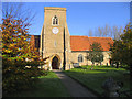
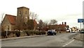
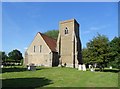
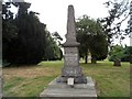
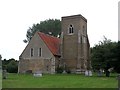
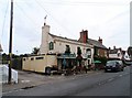
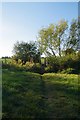
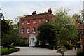
36 photos from this area
Area Information
Key information about the CM5 9NG including its size, population, and administrative classification.
- Area Type
- Postcode
- Area Size
- 1.7 hectares
- Population
- 2464
- Population Density
- 54 people/km²
House Prices in CM5 9NG
9
Properties
£279,667
Average Sold Price
£98,500
Lowest Price
£415,000
Highest Price
Showing 9 properties
| Address | Type | Beds | Baths | Last Sale Price | Last Sale Date | |
|---|---|---|---|---|---|---|
| Bushwood, The Street, High Ongar, Ongar, CM5 9NG | Semi-detached | 4 | 1 | £405,000 | Feb 2020 | |
| Red Lodge, The Street, High Ongar, Ongar, CM5 9NG | Semi-detached | 3 | 2 | £412,500 | Apr 2019 | |
| Wesdale, The Street, High Ongar, Ongar, CM5 9NG | Semi-detached | 3 | - | £415,000 | Jul 2017 | |
| 1, Hazeldine Cottages, The Street, High Ongar, Ongar, CM5 9NG | Semi-detached | - | - | £232,000 | Jul 2005 | |
| Elderfield, The Street, High Ongar, Ongar, CM5 9NG | Terraced | - | - | £98,500 | Apr 1996 | |
| 2, Hazeldine Cottages, The Street, High Ongar, Ongar, CM5 9NG | Semi-detached | - | - | £115,000 | Feb 1996 | |
| Stelwood, The Street, High Ongar, Ongar, CM5 9NG | Semi-detached | - | - | - | - | |
| The Old Hall, The Street, High Ongar, Ongar, CM5 9NG | Semi-detached | - | - | - | - | |
| High Ongar Post Office, The Street, High Ongar, Ongar, CM5 9NG | shop | - | - | - | - |
Energy Efficiency in CM5 9NG
Amenities
Schools
| Rank | School | Type | Entry gender | Ages |
|---|
Explore more schools in this area
Go to Schools tabDemographics
Household Size
Family (3-5 people)
most common
Accommodation Type
Houses
most common
Tenure
74
majority
Ethnic Group
White
most common
Religion
N/A
most common
Household Composition
N/A
most common
Age
47
median
Adults (30-64 years)
most common
Household Deprivation
N/A
with no deprivation
NS-SEC
37
in Lower managerial occupations
Explore more demographic insights in this area
Go to Demographics tabPlanning
Planning Constraints
- Flood RiskPremium
- Ramsar Wetland SitesPremium
- Area of Outstanding Natural BeautyPremium
- Protected Nature ReservePremium
- Protected WoodlandPremium