Area Overview for CM5 0SP
Photos of CM5 0SP
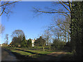
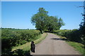
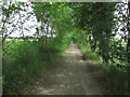


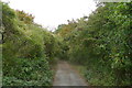

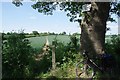
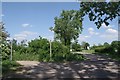
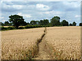
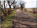
27 photos from this area
Area Information
Key information about the CM5 0SP including its size, population, and administrative classification.
- Area Type
- Postcode
- Area Size
- 74.0 hectares
- Population
- 2464
- Population Density
- 54 people/km²
House Prices in CM5 0SP
12
Properties
£716,750
Average Sold Price
£327,000
Lowest Price
£1,325,000
Highest Price
Showing 12 properties
| Address | Type | Beds | Baths | Last Sale Price | Last Sale Date | |
|---|---|---|---|---|---|---|
| Willow Tree Cottage, Shellow Road, Willingale, Ongar, CM5 0SP | Detached | 5 | 3 | £1,325,000 | Dec 2025 | |
| Chase Cottage, Shellow Road, Willingale, Ongar, CM5 0SP | house | - | - | £800,000 | Feb 2016 | |
| 2, Torrells Hall Cottages, Shellow Road, Willingale, Ongar, CM5 0SP | Semi-detached | - | - | £415,000 | Dec 2006 | |
| 7, Torrells Hall Cottages, Shellow Road, Willingale, Ongar, CM5 0SP | Detached | 4 | 2 | £327,000 | Oct 2003 | |
| The Lodge, Torrells Hall, Shellow Road, Willingale, Ongar, CM5 0SP | Detached | 4 | 2 | - | - | |
| 8, Torrells Hall Cottages, Shellow Road, Willingale, Ongar, CM5 0SP | house | 4 | - | - | - | |
| Torrells Hall Bungalow Now Chase Cottage, Shellow Road, Willingale, Ongar, CM5 0SP | Detached | - | - | - | - | |
| Rootes Now Willow Tree Cottage, Shellow Road, Willingale, Ongar, CM5 0SP | undefined | - | - | - | - | |
| 3, Torrells Hall Cottages, Shellow Road, Willingale, Ongar, CM5 0SP | Semi-detached | - | - | - | - | |
| 1, Torrells Hall Cottages, Shellow Road, Willingale, Ongar, CM5 0SP | house | - | - | - | - |
Page 1 of 2
Energy Efficiency in CM5 0SP
Amenities
Schools
| Rank | School | Type | Entry gender | Ages |
|---|
Explore more schools in this area
Go to Schools tabDemographics
Household Size
Family (3-5 people)
most common
Accommodation Type
Houses
most common
Tenure
74
majority
Ethnic Group
White
most common
Religion
N/A
most common
Household Composition
N/A
most common
Age
47
median
Adults (30-64 years)
most common
Household Deprivation
N/A
with no deprivation
NS-SEC
37
in Lower managerial occupations
Explore more demographic insights in this area
Go to Demographics tabPlanning
Planning Constraints
- Flood RiskPremium
- Ramsar Wetland SitesPremium
- Area of Outstanding Natural BeautyPremium
- Protected Nature ReservePremium
- Protected WoodlandPremium