Area Overview for CM5 0RW
Photos of CM5 0RW
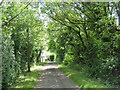

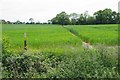
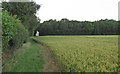
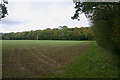
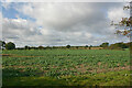
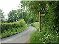
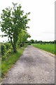
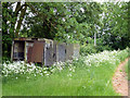
9 photos from this area
Area Information
Key information about the CM5 0RW including its size, population, and administrative classification.
- Area Type
- Postcode
- Area Size
- 1.1 km²
- Population
- 2390
- Population Density
- 55 people/km²
House Prices in CM5 0RW
14
Properties
£734,556
Average Sold Price
£488,950
Lowest Price
£1,087,500
Highest Price
Showing 14 properties
| Address | Type | Beds | Baths | Last Sale Price | Last Sale Date | |
|---|---|---|---|---|---|---|
| Corbetts Cottage, Norwood End, Fyfield, Ongar, CM5 0RW | Detached | - | - | £595,000 | Jan 2021 | |
| Corbetts House, Norwood End, Fyfield, Ongar, CM5 0RW | house | - | - | £520,000 | Mar 2020 | |
| Forest Heights, Norwood End, Fyfield, Ongar, CM5 0RW | Detached | - | - | £1,075,000 | Mar 2016 | |
| Ballyglass, Norwood End, Fyfield, Ongar, CM5 0RW | Detached | - | - | £600,000 | Dec 2015 | |
| The Glen, Norwood End, Fyfield, Ongar, CM5 0RW | Detached | 4 | - | £760,000 | Aug 2015 | |
| High Acre, Norwood End, Fyfield, Ongar, CM5 0RW | Detached | 3 | 2 | £750,000 | May 2012 | |
| Holmfield, Norwood End, Fyfield, Ongar, CM5 0RW | Detached | - | - | £488,950 | Aug 2001 | |
| Norwood End House, Norwood End, Fyfield, Ongar, CM5 0RW | house | 4 | - | £1,087,500 | Aug 2001 | |
| Tennis 101M From Dame Annys, Norwood End 59M From Norwood End, Norwood End, Fyfield, Ongar, CM5 0RW | Leisure | - | - | - | - | |
| Caravan, Wayside, Norwood End, Fyfield, Ongar, CM5 0RW | Mobile Home | - | - | - | - |
Page 1 of 2
Energy Efficiency in CM5 0RW
Amenities
Schools
| Rank | School | Type | Entry gender | Ages |
|---|
Explore more schools in this area
Go to Schools tabDemographics
Household Size
Two person
most common
Accommodation Type
Houses
most common
Tenure
76
majority
Ethnic Group
White
most common
Religion
N/A
most common
Household Composition
N/A
most common
Age
47
median
Adults (30-64 years)
most common
Household Deprivation
N/A
with no deprivation
NS-SEC
39
in Lower managerial occupations
Explore more demographic insights in this area
Go to Demographics tabPlanning
Planning Constraints
- Flood RiskPremium
- Ramsar Wetland SitesPremium
- Area of Outstanding Natural BeautyPremium
- Protected Nature ReservePremium
- Protected WoodlandPremium