Area Overview for CM5 0HW
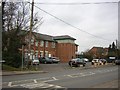
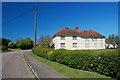
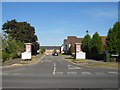
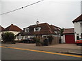
Photos of CM5 0HW


Area Information
Living in CM5 0HW means inhabiting a small, tightly knit residential cluster in the Epping Forest District of Essex. With a population of 2,760 and a density of 987 people per square kilometre, this area balances compact living with the charm of a historic market town. Centred around Chipping Ongar, it retains echoes of its Norman origins, including medieval landmarks like St Martin’s Church and Greensted’s 11th-century log nave. Daily life here is shaped by its proximity to both rural tranquillity and accessible amenities. The area’s small size means residents are close to local shops, schools, and the North Weald Airport, while its historical roots offer a distinct character. This is a place where traditional architecture meets modern convenience, with broadband scores in the excellent range (91/100) and a low crime risk (72/100). For those seeking a blend of heritage and practicality, CM5 0HW offers a self-contained yet connected lifestyle.
- Area Type
- Postcode
- Area Size
- Not available
- Population
- 2760
- Population Density
- 987 people/km²
The property market in CM5 0HW is largely owner-occupied, with 60% of homes owned by residents rather than rented. The area’s housing stock consists predominantly of houses, reflecting its traditional, low-density character. This contrasts with more urban areas where flats or apartments dominate. The small size of the postcode area means the housing stock is limited, making it a niche market for buyers seeking a specific location. For those considering the surrounding areas, the proximity to Chipping Ongar and Epping Forest District offers additional options. The focus on houses suggests a demand for space, which may appeal to families or those prioritising private gardens. However, the limited supply could mean competition for available properties.
House Prices in CM5 0HW
No properties found in this postcode.
Energy Efficiency in CM5 0HW
The lifestyle in CM5 0HW is shaped by its proximity to retail and leisure amenities. Within practical reach are Tesco Ongar, Sainsburys Chipping, and the Chelmsford Star Co-operative Society, offering everyday shopping needs. The North Weald Airport, though not a major hub, provides a direct link to regional travel. The area’s small size means these amenities are accessible without long commutes. For residents, this balance of retail and transport options supports a convenient, self-sufficient lifestyle. The historical character of the area, with landmarks like St Martin’s Church and Ongar Bridge, adds cultural depth to daily life. While the data does not mention parks or dining venues, the presence of local shops and the airport hints at a practical, community-focused environment.
Amenities
Schools
Residents of CM5 0HW have access to a range of schools, including Ongar Primary School (primary), Ongar Comprehensive School (primary), and The Ongar Academy (academy with an Ofsted rating of ‘good’). The presence of both primary and academy schools offers flexibility for families, with the latter providing a broader curriculum. The duplication of Ongar Primary School in the data may indicate multiple campuses or a focus on primary education in the area. This mix of school types ensures options for different educational preferences, from traditional primary schooling to academies with distinct specialisms. For parents, the ‘good’ Ofsted rating at The Ongar Academy signals a reliable standard of education, while the primary schools cater to younger children.
| Rank | School | Type | Entry gender | Ages |
|---|
Explore more schools in this area
Go to Schools tabDemographics
The community in CM5 0HW is predominantly composed of adults aged 30–64, with a median age of 47. Home ownership stands at 60%, reflecting a stable, long-term resident base. The area is characterised by houses rather than flats, aligning with its traditional, low-density layout. The predominant ethnic group is White, which shapes the cultural and social fabric of the neighbourhood. With 2,760 residents spread across 987 people per square kilometre, the area feels intimate yet functional. The absence of specific deprivation data means the quality of life is inferred from the low crime risk (72/100) and the presence of essential amenities. This demographic profile suggests a mature, family-oriented community with a focus on stability and local connectivity.
Household Size
Accommodation Type
Tenure
Ethnic Group
Religion
Household Composition
Age
Household Deprivation
NS-SEC
Explore more demographic insights in this area
Go to Demographics tabPlanning
Planning Constraints
- Flood RiskPremium
- Ramsar Wetland SitesPremium
- Area of Outstanding Natural BeautyPremium
- Protected Nature ReservePremium
- Protected WoodlandPremium