Area Overview for CM5 0AL
Photos of CM5 0AL
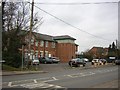
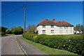
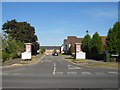
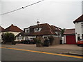
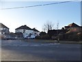
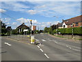
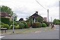
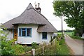
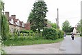
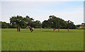

19 photos from this area
Area Information
Key information about the CM5 0AL including its size, population, and administrative classification.
- Area Type
- Postcode
- Area Size
- 6.0 hectares
- Population
- 2760
- Population Density
- 987 people/km²
House Prices in CM5 0AL
13
Properties
£359,169
Average Sold Price
£105,000
Lowest Price
£555,555
Highest Price
Showing 13 properties
| Address | Type | Beds | Baths | Last Sale Price | Last Sale Date | |
|---|---|---|---|---|---|---|
| 75 Fyfield Road, Ongar, CM5 0AL | house | - | - | £555,555 | Oct 2021 | |
| Pleasant Views, 69 Fyfield Road, Ongar, CM5 0AL | house | 3 | 2 | £530,000 | Nov 2020 | |
| 57B Fyfield Road, Ongar, CM5 0AL | Detached | 4 | 2 | £450,000 | Nov 2017 | |
| 61 Fyfield Road, Ongar, CM5 0AL | Semi-detached | 4 | - | £500,000 | Mar 2017 | |
| 59 Fyfield Road, Ongar, CM5 0AL | Semi-detached | - | - | £192,793 | Oct 2002 | |
| 77 Fyfield Road, Ongar, CM5 0AL | Detached | - | - | £425,000 | Jan 2000 | |
| The Chimes, 63 Fyfield Road, Ongar, CM5 0AL | Semi-detached | - | - | £115,000 | Apr 1997 | |
| 73 Fyfield Road, Ongar, CM5 0AL | Semi-detached | - | - | £105,000 | Jan 1997 | |
| The Roothings, 57A Fyfield Road, Ongar, CM5 0AL | Detached | 4 | 2 | - | - | |
| 71 Fyfield Road, Ongar, CM5 0AL | house | - | - | - | - |
Page 1 of 2
Energy Efficiency in CM5 0AL
Amenities
Schools
| Rank | School | Type | Entry gender | Ages |
|---|
Explore more schools in this area
Go to Schools tabDemographics
Household Size
Family (3-5 people)
most common
Accommodation Type
Houses
most common
Tenure
60
majority
Ethnic Group
White
most common
Religion
N/A
most common
Household Composition
N/A
most common
Age
47
median
Adults (30-64 years)
most common
Household Deprivation
N/A
with no deprivation
NS-SEC
27
in Lower managerial occupations
Explore more demographic insights in this area
Go to Demographics tabPlanning
Planning Constraints
- Flood RiskPremium
- Ramsar Wetland SitesPremium
- Area of Outstanding Natural BeautyPremium
- Protected Nature ReservePremium
- Protected WoodlandPremium