Area Overview for CM4 9PD
Photos of CM4 9PD
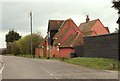

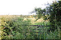

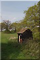
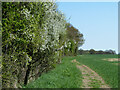
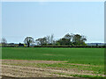
10 photos from this area
Area Information
Key information about the CM4 9PD including its size, population, and administrative classification.
- Area Type
- Postcode
- Area Size
- 91.3 hectares
- Population
- 1724
- Population Density
- 73 people/km²
House Prices in CM4 9PD
20
Properties
£1,376,500
Average Sold Price
£435,000
Lowest Price
£2,020,000
Highest Price
Showing 20 properties
| Address | Type | Beds | Baths | Last Sale Price | Last Sale Date | |
|---|---|---|---|---|---|---|
| Fairmead, Ingatestone Road, Stock, Ingatestone, CM4 9PD | house | 5 | 3 | £1,700,000 | Jan 2025 | |
| Hawthorn House, Ingatestone Road, Stock, Ingatestone, CM4 9PD | Detached | 5 | 4 | £1,700,000 | Jul 2024 | |
| Beech House, Ingatestone Road, Stock, Ingatestone, CM4 9PD | Detached | - | - | £1,650,000 | Jul 2024 | |
| Birch House, Ingatestone Road, Stock, Ingatestone, CM4 9PD | Detached | - | - | £1,550,000 | May 2024 | |
| Longmeads, Ingatestone Road, Stock, Ingatestone, CM4 9PD | house | 5 | 4 | £2,020,000 | Jun 2021 | |
| Stock House, Ingatestone Road, Stock, Ingatestone, CM4 9PD | house | 5 | - | £1,050,000 | Feb 2021 | |
| Brock Farm Bungalow, Ingatestone Road, Stock, Ingatestone, CM4 9PD | Detached | 5 | 3 | £1,100,000 | Dec 2020 | |
| Stratton House, Ingatestone Road, Stock, Ingatestone, CM4 9PD | Detached | 3 | 3 | £980,000 | Jan 2020 | |
| The Molineux, Honeypot Lane, Stock, Ingatestone, CM4 9PD | Bungalow | 3 | - | £1,580,000 | Nov 2013 | |
| Brookfield, Ingatestone Road, Stock, Ingatestone, CM4 9PD | Detached | - | - | £435,000 | Jan 2000 |
Page 1 of 2
Energy Efficiency in CM4 9PD
Amenities
Schools
| Rank | School | Type | Entry gender | Ages |
|---|
Explore more schools in this area
Go to Schools tabDemographics
Household Size
Two person
most common
Accommodation Type
Houses
most common
Tenure
66
majority
Ethnic Group
White
most common
Religion
N/A
most common
Household Composition
N/A
most common
Age
47
median
Adults (30-64 years)
most common
Household Deprivation
N/A
with no deprivation
NS-SEC
37
in Lower managerial occupations
Explore more demographic insights in this area
Go to Demographics tabPlanning
Planning Constraints
- Flood RiskPremium
- Ramsar Wetland SitesPremium
- Area of Outstanding Natural BeautyPremium
- Protected Nature ReservePremium
- Protected WoodlandPremium