Area Overview for CM4 0RE
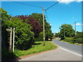
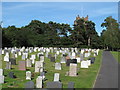
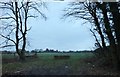
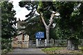
Photos of CM4 0RE

Area Information
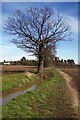
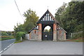
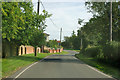
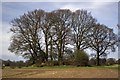
Living in CM4 0RE, a small postcode in Essex, means being part of a quiet, rural parish with a distinct character shaped by its history and surroundings. The area, covering nearly 4,000 acres, lies within the Metropolitan Green Belt and is defined by ribbon development along historic routes like the A12. With a population of 1,523 and a density of 121 people per square kilometre, it balances low population density with a sense of community. The villages of Ingatestone and Fryerning, formed in 1889, retain their charm through conservation areas and historic landmarks such as Ingatestone Hall and sarsen stones marking Saxon origins. Daily life here is influenced by its commuter appeal, with rail links to Shenfield and Billericay, and proximity to Chelmsford. The area’s low crime risk and absence of environmental constraints make it attractive for families seeking a peaceful, low-density lifestyle while remaining within reach of urban amenities.
- Area Type
- Postcode
- Area Size
- Not available
- Population
- 1523
- Population Density
- 121 people/km²
The property market in CM4 0RE is characterised by a high rate of home ownership, with 63% of residents owning their homes. The predominant accommodation type is houses, reflecting the area’s rural and semi-rural nature. This suggests a market skewed towards owner-occupied properties rather than rentals, which may limit availability for renters. The small population and low density mean the housing stock is likely to be spread out, with properties situated along historic routes and within conservation areas. Buyers should consider that the area’s limited size and proximity to the Green Belt may restrict development, making it a stable but niche market. For those seeking a home in CM4 0RE, the focus is on established properties rather than new builds, with potential for character homes in conservation areas. Proximity to rail links and schools adds appeal for families, though the area’s small footprint means competition for available listings may be limited.
House Prices in CM4 0RE
No properties found in this postcode.
Energy Efficiency in CM4 0RE
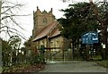
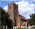
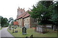
The lifestyle in CM4 0RE is defined by its rural setting and proximity to local amenities. Residents have access to five retail outlets, including Budgens Ingatestone and co-operative societies, offering everyday shopping needs. The area’s rail stations—Ingatestone, Shenfield, and Billericay—provide connections to broader networks, enhancing mobility for commuters. While the postcode itself is small, the surrounding villages of Ingatestone and Fryerning offer historic sites like Ingatestone Hall, St Edmund and St Mary Church, and the Fryerning Conservation Area. These landmarks contribute to a sense of heritage and community. The area’s low density and Green Belt location mean open spaces are abundant, though specific parks or leisure facilities are not detailed in the data. For those prioritising convenience, the combination of retail, rail, and historical sites creates a lifestyle that blends rural charm with practical connectivity.
Amenities
Schools
Residents of CM4 0RE have access to several primary schools, including Ingatestone Infant School and Ingatestone and Fryerning Church of England Voluntary Aided Junior School, both of which operate as primary institutions. Additionally, there are two academies: Ingatestone Infant School and Ingatestone and Fryerning Church of England Junior School. While specific Ofsted ratings are not provided, the presence of multiple schools suggests a range of educational options for families. The mix of traditional state schools and academies may offer varied teaching approaches and resources. For parents, this diversity could provide flexibility in choosing a school that aligns with their child’s needs. However, the area’s small size means school catchment areas may be limited, and families should verify admissions policies. The proximity of these schools to CM4 0RE reinforces the area’s appeal for households prioritising education.
| Rank | School | Type | Entry gender | Ages |
|---|
Explore more schools in this area
Go to Schools tabDemographics
The community in CM4 0RE is predominantly composed of adults aged 30–64, with a median age of 47. Home ownership is strong, with 63% of residents owning their homes, and the majority live in houses rather than flats. The predominant ethnic group is White, reflecting the area’s traditional rural character. This demographic profile suggests a stable, established population with long-term ties to the area. The low population density of 121 people per square kilometre indicates a spread-out, less congested environment. While specific data on deprivation is not provided, the combination of high home ownership and low crime risk suggests a relatively affluent and secure living environment. The presence of primary schools and rail connectivity further supports a family-friendly atmosphere, though the area’s small size means amenities are limited to immediate surroundings.
Household Size
Accommodation Type
Tenure
Ethnic Group
Religion
Household Composition
Age
Household Deprivation
NS-SEC
Explore more demographic insights in this area
Go to Demographics tabPlanning
Planning Constraints
- Flood RiskPremium
- Ramsar Wetland SitesPremium
- Area of Outstanding Natural BeautyPremium
- Protected Nature ReservePremium
- Protected WoodlandPremium