Area Overview for CM4 0NN
Photos of CM4 0NN

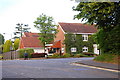


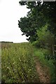


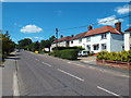

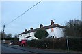
44 photos from this area
Area Information
Key information about the CM4 0NN including its size, population, and administrative classification.
- Area Type
- Postcode
- Area Size
- 28.0 hectares
- Population
- 1523
- Population Density
- 121 people/km²
House Prices in CM4 0NN
13
Properties
£1,174,375
Average Sold Price
£350,000
Lowest Price
£1,800,000
Highest Price
Showing 13 properties
| Address | Type | Beds | Baths | Last Sale Price | Last Sale Date | |
|---|---|---|---|---|---|---|
| Hedgerow, 68 Fryerning Lane, Ingatestone, CM4 0NN | Detached | 5 | 4 | £1,450,000 | Mar 2025 | |
| Wychwood, 76 Fryerning Lane, Ingatestone, CM4 0NN | house | - | - | £1,625,000 | Jun 2021 | |
| Wagtails, 70 Fryerning Lane, Ingatestone, CM4 0NN | Detached | 4 | 2 | £1,252,500 | Sep 2020 | |
| Wadhams, 82 Fryerning Lane, Ingatestone, CM4 0NN | Detached | 6 | 3 | £1,800,000 | Nov 2018 | |
| 105 Fryerning Lane, Ingatestone, CM4 0NN | house | 4 | - | £727,500 | Jul 2016 | |
| Cherwell House, 78 Fryerning Lane, Ingatestone, CM4 0NN | house | - | - | £1,750,000 | Aug 2010 | |
| Gernons, 66 Fryerning Lane, Ingatestone, CM4 0NN | Detached | - | - | £350,000 | Oct 1997 | |
| Larch Hill, 80 Fryerning Lane, Ingatestone, CM4 0NN | Detached | - | - | £440,000 | Jul 1997 | |
| Wellmead, 84 Fryerning Lane, Ingatestone, CM4 0NN | Detached | 6 | 3 | - | - | |
| 74 Fryerning Lane, Ingatestone, CM4 0NN | house | - | - | - | - |
Page 1 of 2
Energy Efficiency in CM4 0NN
Amenities
Schools
| Rank | School | Type | Entry gender | Ages |
|---|
Explore more schools in this area
Go to Schools tabDemographics
Household Size
Two person
most common
Accommodation Type
Houses
most common
Tenure
63
majority
Ethnic Group
White
most common
Religion
N/A
most common
Household Composition
N/A
most common
Age
47
median
Adults (30-64 years)
most common
Household Deprivation
N/A
with no deprivation
NS-SEC
41
in Lower managerial occupations
Explore more demographic insights in this area
Go to Demographics tabPlanning
Planning Constraints
- Flood RiskPremium
- Ramsar Wetland SitesPremium
- Area of Outstanding Natural BeautyPremium
- Protected Nature ReservePremium
- Protected WoodlandPremium