Area Overview for CM4 0HZ
Photos of CM4 0HZ
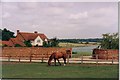
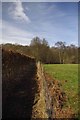
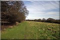
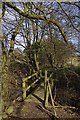
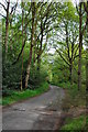
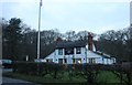

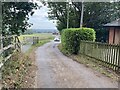
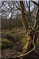
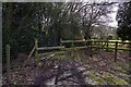
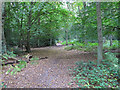
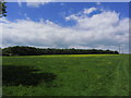
17 photos from this area
Area Information
Key information about the CM4 0HZ including its size, population, and administrative classification.
- Area Type
- Postcode
- Area Size
- 24.1 hectares
- Population
- 1523
- Population Density
- 121 people/km²
House Prices in CM4 0HZ
12
Properties
£1,074,063
Average Sold Price
£500,000
Lowest Price
£1,685,000
Highest Price
Showing 12 properties
| Address | Type | Beds | Baths | Last Sale Price | Last Sale Date | |
|---|---|---|---|---|---|---|
| Chaseside, Hardings Lane, Fryerning, CM4 0HZ | Bungalow | - | - | £1,450,000 | Dec 2022 | |
| Meadowcroft, Hardings Lane, Fryerning, CM4 0HZ | house | - | - | £1,685,000 | Jan 2021 | |
| Woodlands, Hardings Lane, Fryerning, CM4 0HZ | Detached | 4 | 3 | £1,337,500 | Aug 2016 | |
| Millbank, Hardings Lane, Fryerning, CM4 0HZ | Semi-detached | 3 | - | £620,000 | Jul 2014 | |
| Bracken Cottage, Hardings Lane, Fryerning, CM4 0HZ | Detached | 4 | 2 | £1,625,000 | May 2014 | |
| Hollyside, Hardings Lane, Fryerning, CM4 0HZ | Semi-detached | - | - | £500,000 | Sep 2012 | |
| Brookfield Cottage, Hardings Lane, Fryerning, CM4 0HZ | Detached | 4 | 3 | £875,000 | Sep 2012 | |
| Slab Cottage, Hardings Lane, Fryerning, CM4 0HZ | Bungalow | - | - | £500,000 | Jul 2008 | |
| Hardings Farm, Hardings Lane, Fryerning, CM4 0HZ | Detached | 3 | 3 | - | - | |
| Spinney Cottage, Hardings Lane, Fryerning, CM4 0HZ | Detached | 4 | 1 | - | - |
Page 1 of 2
Energy Efficiency in CM4 0HZ
Amenities
Schools
| Rank | School | Type | Entry gender | Ages |
|---|
Explore more schools in this area
Go to Schools tabDemographics
Household Size
Two person
most common
Accommodation Type
Houses
most common
Tenure
63
majority
Ethnic Group
White
most common
Religion
N/A
most common
Household Composition
N/A
most common
Age
47
median
Adults (30-64 years)
most common
Household Deprivation
N/A
with no deprivation
NS-SEC
41
in Lower managerial occupations
Explore more demographic insights in this area
Go to Demographics tabPlanning
Planning Constraints
- Flood RiskPremium
- Ramsar Wetland SitesPremium
- Area of Outstanding Natural BeautyPremium
- Protected Nature ReservePremium
- Protected WoodlandPremium