Area Overview for CM4 0BY
Photos of CM4 0BY

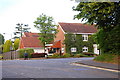

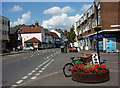


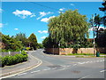

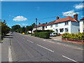

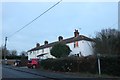

44 photos from this area
Area Information
Key information about the CM4 0BY including its size, population, and administrative classification.
- Area Type
- Postcode
- Area Size
- 1.4 hectares
- Population
- 1717
- Population Density
- 769 people/km²
House Prices in CM4 0BY
25
Properties
£561,334
Average Sold Price
£235,000
Lowest Price
£1,625,000
Highest Price
Showing 25 properties
| Address | Type | Beds | Baths | Last Sale Price | Last Sale Date | |
|---|---|---|---|---|---|---|
| Ingatestone Cottage, 11 Market Place, Ingatestone, CM4 0BY | Terraced | 2 | - | £545,000 | May 2024 | |
| Snapdragons, Market Place, Ingatestone, CM4 0BY | house | - | - | £1,625,000 | Apr 2021 | |
| 9 Market Place, Ingatestone, CM4 0BY | house | 2 | - | £322,000 | Apr 2011 | |
| St Cydds, 18 Market Place, Ingatestone, CM4 0BY | Semi-detached | 3 | 1 | £385,000 | Mar 2008 | |
| Chestnut Cottage, 7 Market Place, Ingatestone, CM4 0BY | Flat | 1 | - | £400,000 | Jul 2006 | |
| Market Cottage, Market Place, Ingatestone, CM4 0BY | Detached | 2 | 1 | £415,000 | Jun 2006 | |
| Laburnum Cottage, 16 Market Place, Ingatestone, CM4 0BY | Detached | - | - | £235,000 | May 2006 | |
| Chapel House, 13 Market Place, Ingatestone, CM4 0BY | Detached | - | - | £565,000 | Mar 2001 | |
| Old Market Place, Market Place, Ingatestone, CM4 0BY | house | - | - | £560,006 | Mar 1997 | |
| Flat 5, The Warehouse, Market Place, Ingatestone, CM4 0BY | Flat | 2 | - | - | - |
Page 1 of 3
Energy Efficiency in CM4 0BY
Amenities
Schools
| Rank | School | Type | Entry gender | Ages |
|---|
Explore more schools in this area
Go to Schools tabDemographics
Household Size
One person
most common
Accommodation Type
Houses
most common
Tenure
69
majority
Ethnic Group
White
most common
Religion
N/A
most common
Household Composition
N/A
most common
Age
47
median
Adults (30-64 years)
most common
Household Deprivation
N/A
with no deprivation
NS-SEC
49
in Lower managerial occupations
Explore more demographic insights in this area
Go to Demographics tabPlanning
Planning Constraints
- Flood RiskPremium
- Ramsar Wetland SitesPremium
- Area of Outstanding Natural BeautyPremium
- Protected Nature ReservePremium
- Protected WoodlandPremium