Area Overview for CM3 8XB
Photos of CM3 8XB
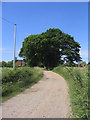
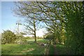
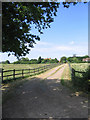
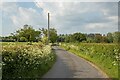
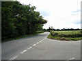
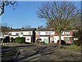
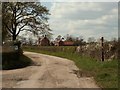
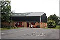
9 photos from this area
Area Information
Key information about the CM3 8XB including its size, population, and administrative classification.
- Area Type
- Postcode
- Area Size
- 5.4 hectares
- Population
- 1770
- Population Density
- 91 people/km²
House Prices in CM3 8XB
15
Properties
£708,091
Average Sold Price
£300,000
Lowest Price
£957,000
Highest Price
Showing 15 properties
| Address | Type | Beds | Baths | Last Sale Price | Last Sale Date | |
|---|---|---|---|---|---|---|
| 7 Abbey Fields, East Hanningfield, Chelmsford, CM3 8XB | Detached | 4 | 2 | £940,000 | Aug 2025 | |
| 15 Abbey Fields, East Hanningfield, Chelmsford, CM3 8XB | Retail | 4 | 2 | £870,000 | Jan 2023 | |
| 12 Abbey Fields, East Hanningfield, Chelmsford, CM3 8XB | house | - | - | £957,000 | Nov 2021 | |
| 3 Abbey Fields, East Hanningfield, Chelmsford, CM3 8XB | Detached | 5 | - | £790,000 | Sep 2019 | |
| 13 Abbey Fields, East Hanningfield, Chelmsford, CM3 8XB | house | - | - | £935,000 | Jul 2018 | |
| 4 Abbey Fields, East Hanningfield, Chelmsford, CM3 8XB | Detached | 4 | 2 | £670,000 | Jul 2014 | |
| 9 Abbey Fields, East Hanningfield, Chelmsford, CM3 8XB | Detached | - | - | £765,000 | Sep 2009 | |
| 10 Abbey Fields, East Hanningfield, Chelmsford, CM3 8XB | Detached | 5 | 3 | £517,000 | Aug 2004 | |
| 14 Abbey Fields, East Hanningfield, Chelmsford, CM3 8XB | Detached | - | - | £625,000 | Apr 2004 | |
| 2 Abbey Fields, East Hanningfield, Chelmsford, CM3 8XB | Detached | 5 | 2 | £420,000 | Apr 2003 |
Page 1 of 2
Energy Efficiency in CM3 8XB
Amenities
Schools
| Rank | School | Type | Entry gender | Ages |
|---|
Explore more schools in this area
Go to Schools tabDemographics
Household Size
Two person
most common
Accommodation Type
Houses
most common
Tenure
79
majority
Ethnic Group
White
most common
Religion
N/A
most common
Household Composition
N/A
most common
Age
47
median
Adults (30-64 years)
most common
Household Deprivation
N/A
with no deprivation
NS-SEC
41
in Lower managerial occupations
Explore more demographic insights in this area
Go to Demographics tabPlanning
Planning Constraints
- Flood RiskPremium
- Ramsar Wetland SitesPremium
- Area of Outstanding Natural BeautyPremium
- Protected Nature ReservePremium
- Protected WoodlandPremium