Area Overview for CM3 8JB
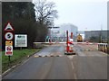
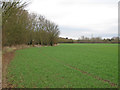
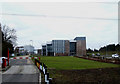
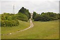
Photos of CM3 8JB

Area Information
Living in CM3 8JB means being part of a small, tightly knit residential cluster in West Hanningfield, Essex. With a population of 1,495 and a population density of 133 people per square kilometre, the area offers a quiet, low-density lifestyle just 5 miles from Chelmsford. The village sits north of Hanningfield Reservoir, surrounded by nearby settlements like South Hanningfield and Great Baddow. Historically, the area dates to the 13th century, with remnants of its past visible in its Grade II* listed church and timber-framed buildings. Daily life here balances rural tranquillity with practical access to rail networks and local amenities. The mix of historic architecture and modern infrastructure makes CM3 8JB appealing to those seeking a peaceful yet connected existence. Its proximity to Chelmsford and surrounding suburbs ensures residents can access urban conveniences without sacrificing the charm of village life.
- Area Type
- Postcode
- Area Size
- Not available
- Population
- 1495
- Population Density
- 133 people/km²
The property market in CM3 8JB is dominated by owner-occupied homes, with 86% of properties owned by residents rather than rented. The accommodation type is primarily houses, which is typical of rural and semi-rural areas. This suggests a market skewed towards family homes and long-term residents rather than short-term rentals or high-density housing. Given the small size of the area and its proximity to larger towns like Chelmsford, property availability is limited, making it a niche market for buyers seeking a quiet, low-density environment. The high home ownership rate indicates strong community ties, but buyers should consider the limited housing stock and the potential for slower price fluctuations compared to more urban areas.
House Prices in CM3 8JB
No properties found in this postcode.
Energy Efficiency in CM3 8JB
Residents of CM3 8JB have access to a range of nearby amenities, including five retail outlets such as Co-op Wickford and M&S South Woodham Ferrers, offering everyday shopping convenience. Three railway stations—Battlesbridge, Wickford, and South Woodham Ferrers—provide easy access to urban centres, while a single bus stop at Nelsons Coach Station connects to local routes. The village itself features a pub, primary school, village hall, and listed buildings, fostering a sense of community. The proximity to Hanningfield Reservoir adds recreational value, though no parks are explicitly listed. The blend of historic charm and practical amenities makes daily life here both convenient and rooted in tradition.
Amenities
Schools
The nearest school to CM3 8JB is St Peters Church of England Voluntary Aided Primary School in West Hanningfield, which has an Ofsted rating of ‘good’. This primary school serves the local community, providing education for younger children. Families in the area will need to arrange secondary schooling elsewhere, as no secondary schools are listed in the data. The presence of a well-rated primary school is a key advantage for parents, offering a reliable foundation for early education. However, the absence of a secondary school nearby means families may need to consider commuting or enrolling children in schools in nearby towns like Chelmsford.
| Rank | School | Type | Entry gender | Ages |
|---|
Explore more schools in this area
Go to Schools tabDemographics
The community in CM3 8JB is predominantly middle-aged, with a median age of 47 and the most common age range being adults aged 30–64. Home ownership is high at 86%, reflecting a stable, long-term resident base. The area is characterised by houses rather than flats, indicating a focus on family-oriented living. The predominant ethnic group is White, and the data does not indicate significant diversity beyond this. The age profile suggests a mature population, which may influence local services and amenities. With no specific deprivation data provided, the area’s quality of life appears to align with its demographic stability and low population density. This makes CM3 8JB suitable for those prioritising a settled, low-maintenance lifestyle.
Household Size
Accommodation Type
Tenure
Ethnic Group
Religion
Household Composition
Age
Household Deprivation
NS-SEC
Explore more demographic insights in this area
Go to Demographics tabPlanning
Planning Constraints
- Flood RiskPremium
- Ramsar Wetland SitesPremium
- Area of Outstanding Natural BeautyPremium
- Protected Nature ReservePremium
- Protected WoodlandPremium