Area Overview for CM3 8HG
Photos of CM3 8HG
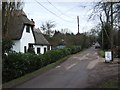
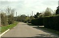
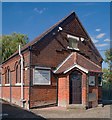
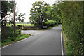
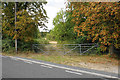
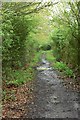
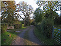
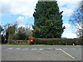
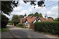
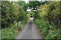
10 photos from this area
Area Information
Key information about the CM3 8HG including its size, population, and administrative classification.
- Area Type
- Postcode
- Area Size
- 12.2 hectares
- Population
- 1393
- Population Density
- 109 people/km²
House Prices in CM3 8HG
10
Properties
£628,094
Average Sold Price
£250,000
Lowest Price
£989,350
Highest Price
Showing 10 properties
| Address | Type | Beds | Baths | Last Sale Price | Last Sale Date | |
|---|---|---|---|---|---|---|
| Starts Cottage, Coalhill, Rettendon, Chelmsford, CM3 8HG | Detached | 3 | 2 | £800,000 | Jul 2024 | |
| Willow Brook, Coalhill, Rettendon, Chelmsford, CM3 8HG | house | - | - | £989,350 | Dec 2023 | |
| Hillcrest, Coalhill, Rettendon, Chelmsford, CM3 8HG | Bungalow | - | - | £875,000 | Aug 2015 | |
| Ivy Cottage, Coalhill, Rettendon, Chelmsford, CM3 8HG | Detached | 4 | - | £577,000 | Feb 2008 | |
| Croft House, Coalhill, Rettendon, Chelmsford, CM3 8HG | Detached | - | - | £892,500 | Jul 2007 | |
| The Old Orchard, Coalhill, Rettendon, Chelmsford, CM3 8HG | Detached | - | - | £635,000 | Aug 2004 | |
| Little Croft, Coalhill, Rettendon, Chelmsford, CM3 8HG | Detached | - | - | £365,000 | Jul 2004 | |
| Woodlands, Coalhill, Rettendon, Chelmsford, CM3 8HG | Detached | 4 | 3 | £250,000 | Jul 2000 | |
| Rose Cottage, Coalhill, Rettendon, Chelmsford, CM3 8HG | Detached | - | - | £269,000 | Dec 1999 | |
| Annexe At Hillcrest, Coalhill, Rettendon, Chelmsford, CM3 8HG | Semi-detached | - | - | - | - |
Energy Efficiency in CM3 8HG
Amenities
Schools
| Rank | School | Type | Entry gender | Ages |
|---|
Explore more schools in this area
Go to Schools tabDemographics
Household Size
Two person
most common
Accommodation Type
Houses
most common
Tenure
85
majority
Ethnic Group
White
most common
Religion
N/A
most common
Household Composition
N/A
most common
Age
47
median
Adults (30-64 years)
most common
Household Deprivation
N/A
with no deprivation
NS-SEC
32
in Lower managerial occupations
Explore more demographic insights in this area
Go to Demographics tabPlanning
Planning Constraints
- Flood RiskPremium
- Ramsar Wetland SitesPremium
- Area of Outstanding Natural BeautyPremium
- Protected Nature ReservePremium
- Protected WoodlandPremium