Area Overview for CM3 8DU
Photos of CM3 8DU
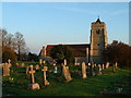

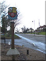
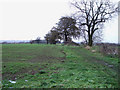

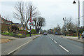
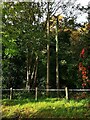

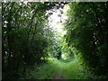

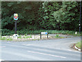
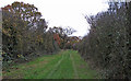
29 photos from this area
Area Information
Key information about the CM3 8DU including its size, population, and administrative classification.
- Area Type
- Postcode
- Area Size
- 21.4 hectares
- Population
- 1651
- Population Density
- 356 people/km²
House Prices in CM3 8DU
46
Properties
£246,675
Average Sold Price
£119,950
Lowest Price
£440,000
Highest Price
Showing 46 properties
| Address | Type | Beds | Baths | Last Sale Price | Last Sale Date | |
|---|---|---|---|---|---|---|
| 37 Meadow Road, Rettendon, Chelmsford, CM3 8DU | Detached | 3 | 1 | £350,000 | Jul 2025 | |
| 45 Meadow Road, Rettendon, Chelmsford, CM3 8DU | Terraced | 3 | 1 | £305,000 | May 2023 | |
| 39 Meadow Road, Rettendon, Chelmsford, CM3 8DU | Semi-detached | 3 | 1 | £407,500 | Sep 2022 | |
| 42 Meadow Road, Rettendon, Chelmsford, CM3 8DU | house | 3 | - | £440,000 | Apr 2022 | |
| 15 Meadow Road, Rettendon, Chelmsford, CM3 8DU | house | - | - | £325,000 | Nov 2021 | |
| 38 Meadow Road, Rettendon, Chelmsford, CM3 8DU | house | - | - | £176,000 | Mar 2021 | |
| 20 Meadow Road, Rettendon, Chelmsford, CM3 8DU | house | - | - | £280,000 | Jan 2021 | |
| 50 Meadow Road, Rettendon, Chelmsford, CM3 8DU | Semi-detached | 3 | 2 | £220,000 | Nov 2015 | |
| 41 Meadow Road, Rettendon, Chelmsford, CM3 8DU | house | - | - | £150,000 | Jun 2013 | |
| 17 Meadow Road, Rettendon, Chelmsford, CM3 8DU | house | - | - | £180,000 | Jul 2011 |
Page 1 of 5
Energy Efficiency in CM3 8DU
Amenities
Schools
| Rank | School | Type | Entry gender | Ages |
|---|
Explore more schools in this area
Go to Schools tabDemographics
Household Size
Family (3-5 people)
most common
Accommodation Type
Houses
most common
Tenure
71
majority
Ethnic Group
White
most common
Religion
N/A
most common
Household Composition
N/A
most common
Age
47
median
Adults (30-64 years)
most common
Household Deprivation
N/A
with no deprivation
NS-SEC
38
in Lower managerial occupations
Explore more demographic insights in this area
Go to Demographics tabPlanning
Planning Constraints
- Flood RiskPremium
- Ramsar Wetland SitesPremium
- Area of Outstanding Natural BeautyPremium
- Protected Nature ReservePremium
- Protected WoodlandPremium